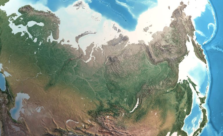
In an age where data drives decision-making, having access to reliable geographical information is crucial. Whether you’re a researcher, urban planner, or just a curious traveler, the right map database can transform your understanding of the world. Discover the best resources that offer comprehensive geographical data, helping you navigate everything from terrain features to demographic insights.
Best Map Database Resources for Comprehensive Geographical Data
You may face challenges when seeking reliable geographical information. Fortunately, various map database resources can help you overcome these hurdles.
- OpenStreetMap (OSM): This community-driven platform offers vast amounts of geospatial data covering roads, trails, cafés, railway stations, and much more. Its data is free to use, making it ideal for various mapping projects.
- Natural Earth: This resource provides public domain map datasets at various scales. It includes detailed shapefiles for physical features, cultural landmarks, and raster data, helping you create aesthetically pleasing maps.
- US Geological Survey (USGS): The USGS offers a wide range of datasets for hydrology, geology, and topography. Its National Map is particularly beneficial for professionals in environmental studies and urban planning.
- ArcGIS Online: This ESRI platform offers a variety of mapping tools and datasets, focusing on analysis and sharing. You can access numerous datasets and utilize them within your mapping projects.
- GeoNames: This geographical database contains over 11 million placenames worldwide, facilitating geocoding and reverse geocoding in mapping projects.
Incorporate these resources thoughtfully into your workflow. As you explore data visualization options, focus on maintaining clarity and accuracy, so your audience can easily interpret your maps. Consider using QA/QC procedures throughout your mapping process to ensure your data’s integrity and reliability.
Online Map Database Resources
Finding reliable geographical data can be challenging, but several online resources can significantly enhance your mapping projects. Here are some top map database options for comprehensive geographic insights.
Hey hey! Don’t forget to subscribe to get our best content 🙂
OpenStreetMap: A Community-Driven Database
OpenStreetMap (OSM) provides a vast repository of geospatial data collected from volunteers worldwide. You can leverage local knowledge to obtain accurate, up-to-date maps, showcasing details like roads, landmarks, and terrain. OSM is freely available for you to visualize, query, download, and modify, ensuring a wide range of applications in urban planning, travel, and research.
Google Maps Platform: Versatile Mapping Tools
Google Maps Platform offers APIs and tools that empower developers to integrate mapping capabilities into applications. With services like the Maps JavaScript API, you can easily embed immersive maps and customize visual features. While the database isn’t freely accessible, its powerful tools allow you to create dynamic mapping solutions for various uses, from navigation to location-based services.
Mapbox: Customizable Geospatial Data
Mapbox provides customizable geospatial data and mapping tools compatible with various applications. You can create stunning, interactive maps tailored to your needs using the Mapbox Studio platform. Its APIs, such as the Mapbox GL JS, enhance user experience through smooth navigation and immersive visuals. With extensive documentation and support, you can tackle complex mapping projects with confidence.
Geospatial Data Repositories
Mapping often presents unique challenges, whether you’re capturing terrain features or conveying demographic trends. You need to ensure accuracy while maintaining readability and engagement, a balance that can be tough to achieve.
Establishing Technical Context
Understanding the core principles of cartography and GIS technology is essential. Familiarize yourself with industry standards, such as the International Cartographic Association’s cartographic guidelines, which cater to various mapping needs. These guidelines ensure you consider elements like scale, data source credibility, and visual hierarchy.
Key Methods with Tool Examples
To enhance your mapping capabilities, consider these methods:
- Data Integration: Combine multiple data sources to enrich your maps. Tools like QGIS allow you to overlay different datasets effortlessly.
- Symbology: Adjust your symbols to reflect data accurately. Software like ArcGIS offers advanced symbology options that can make your maps more informative and appealing.
- Interactive Mapping: Use platforms like Mapbox or Leaflet to create interactive maps, allowing users to explore data dynamically.
Common Technical Issues
You may face common challenges while mapping, including:
- Data Accuracy: Double-check your data sources for credibility and precision. Always cross-reference with established datasets.
- Software Compatibility: Ensure your GIS tools support the file formats you need. Conflicts between software versions can lead to data loss or corruption.
Data Visualization Options
Effectively visualizing data is crucial. Here are some techniques:
- Choropleth Maps: Use these for showing numerical values across geographical areas, ideal for displaying demographic data.
- Heat Maps: These are excellent for visualizing density distributions and can help highlight areas of interest.
- Time Series Visualization: Tools such as Tableau can help present changes over time, offering valuable insights into trends.
Workflow Frameworks
Develop a structured workflow for your mapping projects:
- Define Objectives: Know what you want to communicate with your map.
- Gather Data: Collect reliable and relevant data from authoritative sources.
- Design and Create: Utilize GIS tools to bring your vision to life, ensuring to adhere to visual design principles.
- Review and Revise: Implement a feedback loop where peers can critique your drafts.
- Publish: Share your maps in formats suitable for your audience, whether online or print.
Quality Control Tips
In any mapping project, quality assurance is paramount. Consider these QA/QC best practices:
- Verification: Check your data against primary sources whenever possible.
- Consistency Checks: Look for discrepancies in colors, fonts, and symbology.
- Audience Testing: Share drafts with your target audience to identify areas needing clarity or improvement.
By incorporating these strategies into your mapping practice, you can confidently produce high-quality, engaging maps that effectively communicate your intended message. Always remember: the goal is to balance detail with accessibility for your audience.
Specialty Map Database Resources
Navigating the vast landscape of geographical data can be challenging. Leveraging the right map database resources is essential for producing accurate, insightful maps. Here are some key resources tailored for your mapping needs.
GeoNames: Global Geographic Database
GeoNames offers an extensive geographical database with over 11 million placenames. You can download it free of charge, licensed under a Creative Commons Attribution 4.0 License. It enables you to search for locations by name, latitude, and longitude, providing reliable data suitable for various mapping applications. This resource is valuable for both research and project development.
CartoDB: Data Visualization and Insights
CARTO, formerly known as CartoDB, is a robust platform designed for visualizing and analyzing geographical data. It boasts a Spatial Data Catalog that includes crucial datasets on topography, environment, and demographics. With the ability to render large datasets efficiently, CARTO allows you to maintain data integrity while creating dynamic visualizations—perfect for urban planners and data analysts alike.
Historic Maps: Access to Historical Cartography
Accessing historic maps can enrich your understanding of geographical changes over time. Platforms like David Rumsey Map Collection provide a wealth of digitized historical maps. These resources allow you to explore past cartographic styles and geographical contexts, enhancing storytelling in your mapping projects. Incorporating historical data can also provide valuable insights into evolving environmental and urban developments.
Subscription-Based Map Database Resources
Accessing high-quality map databases is crucial for modern mapping projects. Subscription-based services often provide advanced tools and vast geographical datasets essential for professional cartography.
ESRI ArcGIS: Advanced Mapping Solutions
ESRI ArcGIS offers a comprehensive suite of mapping solutions tailored to various mapping needs. You can create, share, and analyze maps through ArcGIS Online. This platform utilizes an annual subscription model with access to extensive members and service credits for functions like spatial analysis, geocoding, and routing. With offerings such as the Standard and Premium Feature Data Stores, you gain dedicated processing power suitable for intensive data workflows. The integration of ArcGIS Hub allows for enhanced community engagement, available in Basic and Premium license levels, making it a versatile choice for both individual projects and collaborative efforts.
HERE Maps: Location Data and Analytics
HERE Maps excels in delivering precise location data and analytics tailored to various industries. You can leverage HERE Developer Portal for customizable mapping solutions and APIs, streamlining data integration into your applications. With HERE Location Services, you access premium datasets that include real-time traffic, public transit information, and mapping capabilities that cater to urban planning or logistics. Their extensive coverage and detailed analytics help you make informed decisions based on geographical data, assuring the accuracy and efficiency of your mapping projects.
Conclusion
Accessing the right map database resources is crucial for anyone working with geographical data. By leveraging platforms like OpenStreetMap, Natural Earth, and ArcGIS Online, you can enhance your mapping projects and ensure accuracy in your work.
Remember to consider your specific needs when selecting a resource. Whether you’re a researcher, urban planner, or traveler, these tools can provide valuable insights and data.
Stay committed to quality and clarity in your mapping efforts. With the right resources and strategies, you’ll be well-equipped to create engaging and informative maps that effectively communicate your message.

