9 Ways of Blending Traditional and Digital Mapping Methods That Experts Trust
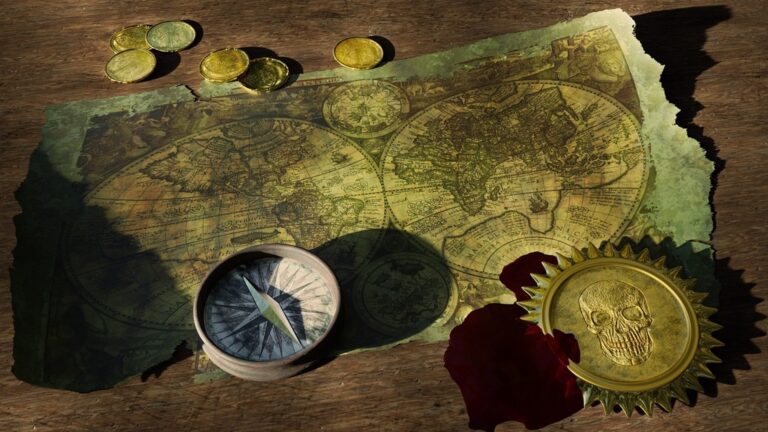
In today’s high-tech world, navigators and cartographers are discovering the unique benefits of combining old-school paper maps with cutting-edge digital mapping tools. Traditional methods offer reliability and a broader perspective that’s impossible to replicate on a small screen, while digital mapping provides real-time updates and precise GPS coordinates.
Experience a warm and spicy fragrance from Maison Margiela. This scent blends lemon, pink pepper, and neroli oil with rum, vanilla, and smoky tobacco for a captivating aroma.
Whether you’re planning a backcountry expedition or navigating through urban landscapes, understanding how to blend these complementary mapping approaches can significantly enhance your navigation skills and keep you oriented even when technology fails. You’ll be better equipped to make informed decisions about your route by mastering both traditional map reading skills and modern digital mapping technologies – it’s about using the best of both worlds to create a more comprehensive and reliable navigation strategy.
Disclosure: As an Amazon Associate, this site earns from qualifying purchases. Thank you!
Understanding the Evolution of Mapping Technologies
Mapping technologies have undergone dramatic transformations from ancient hand-drawn maps to modern digital platforms.
P.S. check out Udemy’s GIS, Mapping & Remote Sensing courses on sale here…
Traditional Cartographic Methods
Traditional cartography relies on precise manual drafting techniques developed over centuries. Surveyors use tools like compasses theodolites and measuring chains to collect field data. Cartographers then transfer this data onto paper using specialized drawing tools ink and watercolors. These methods emphasize map elements like scale bars legends topographic details and careful text placement. Notable traditional techniques include relief shading contour lines and cross-hatching to represent terrain features.
The Rise of Digital Mapping Tools
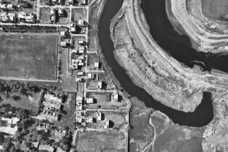
Digital mapping emerged in the 1960s with the development of Geographic Information Systems (GIS). Modern tools like ESRI ArcGIS QGIS and Google Earth Pro revolutionized cartography through automated data processing. These platforms offer features like satellite imagery real-time updates and layered data visualization. Key digital advances include:
Master Google Earth Pro to enhance your real estate business. Visualize properties and analyze locations with powerful mapping tools.
- GPS integration for precise location tracking
- Remote sensing capabilities
- 3D terrain modeling
- Cloud-based collaboration
- Mobile mapping applications
- Automated data collection
Each tool serves specific mapping needs from urban planning to environmental monitoring while maintaining professional cartographic standards.
Combining Paper Maps With Digital Navigation Systems
The successful integration of paper maps and digital navigation tools creates a robust system that maximizes the strengths of both methods.
Benefits of Paper Map Backups
Paper maps provide essential backup navigation when digital devices fail due to battery issues weather conditions or signal loss. They offer reliable orientation points landmarks and terrain features without requiring power or connectivity. Unlike digital screens paper maps display large areas at once helping you maintain broader spatial awareness during route planning. Paper maps also enable quick annotations marking alternative routes safe spots and points of interest with simple tools like pencils or highlighters.
Integrating GPS Coordinates With Physical Maps
Plot GPS coordinates from your digital device onto paper maps using the Universal Transverse Mercator (UTM) grid system for precise location referencing. Start by identifying key waypoints on your digital navigation app then transfer these coordinates to your paper map using a coordinate plotting tool or grid overlay. Match prominent features like trail intersections peaks or water bodies between both systems to verify accuracy. This dual-system approach creates redundancy while maintaining location precision across platforms.
Leveraging Digital Tools to Enhance Traditional Survey Methods
Modern Equipment for Field Surveys
Today’s surveying integrates advanced digital tools with traditional methods for enhanced accuracy. GNSS receivers provide centimeter-level positioning while robotic total stations offer automated measurements and remote operation capabilities. Digital data collectors with built-in cameras streamline field documentation enabling real-time quality checks. Smart levels equipped with electronic sensors ensure precise elevation measurements while portable LiDAR scanners capture detailed 3D point clouds of complex terrain features. These tools sync seamlessly with mobile apps for instant data verification and cloud backup.
Software Solutions for Data Processing
Modern mapping software transforms raw survey data into professional deliverables. AutoCAD Civil 3D and Trimble Business Center handle complex survey calculations while QGIS and ArcGIS Pro enable advanced spatial analysis. Cloud-based platforms like TopoDOT streamline point cloud processing from LiDAR data. Survey-grade post-processing software like MAGNET Tools and Carlson SurvCE correct GPS measurements and adjust traverse networks. These solutions feature automated quality control checks powerful visualization tools and standardized data export options for seamless workflow integration.
Master AutoCAD Civil 3D 2025 with this comprehensive guide. Learn essential techniques for efficient civil engineering design and documentation.
Creating Hybrid Mapping Workflows for Better Accuracy
Hybrid mapping workflows combine traditional and digital methods to maximize accuracy and reliability in mapping projects.
Merging Manual and Digital Data Collection
Start your field survey with manual measurements using tape measures and field notes for baseline data. Supplement these with digital tools like handheld GPS units Trimble R12i or Leica GS18 for precise coordinates. Upload field sketches through mobile apps like Collector for ArcGIS or QField to create georeferenced annotations. Cross-reference paper field notes with digital measurements to identify discrepancies immediately. Use digital cameras with GPS capabilities to capture geotagged site photos that link directly to your mapping software.
Quickly and securely attach your GNSS/GPS equipment with our one-handed quick release adapter, saving you time and reducing instrument damage. Durable aluminum construction ensures a stable connection compatible with R10, R12, R12i receivers and other surveying tools.
Quality Control Through Multiple Methods
Implement a three-tier verification system using different mapping methods. Compare satellite imagery measurements against ground-truth data collected manually. Use ESRI’s ArcGIS Data Reviewer or QGIS validation tools to check for topology errors database consistency. Overlay digital layers with scanned traditional maps to verify feature alignment and spot potential digitization errors. Conduct field verifications using both paper maps and mobile devices to validate critical points waypoints landmarks. Run automated quality checks through specialized software like Global Mapper to identify data gaps or inconsistencies.
Implementing Mobile Technology in Field Mapping
Mobile technology has revolutionized field mapping by enabling real-time data collection integration and instant spatial analysis capabilities.
Smartphone Apps for Mapping
Your smartphone becomes a powerful mapping tool with apps like Avenza Maps Gaia GPS and MapPlus. These apps offer offline mapping capabilities real-time GPS tracking and the ability to collect georeferenced data points. You can mark waypoints record tracks and add field notes with photos directly through your device. Essential features include custom basemap support coordinate system flexibility and cloud synchronization for seamless data transfer to desktop GIS platforms.
Explore 63 trails with detailed difficulty, distance, and elevation information. This guide covers public access routes for various backcountry activities and references 45 USGS topographic maps.
Tablet-Based Data Collection Systems
Tablets enhance field mapping with their larger screens and robust data collection capabilities through apps like ESRI Collector and QField. You’ll benefit from improved form-based data entry detailed aerial imagery viewing and multi-layer visualization. These systems support complex attribute collection GPS accuracy monitoring and real-time team collaboration. Professional surveyors often prefer tablets for their ability to handle detailed maps CAD drawings and high-resolution imagery while maintaining mobility in the field.
Preserving Traditional Knowledge in Digital Formats
Documenting Local Geographic Knowledge
Local communities’ spatial knowledge forms a crucial layer of geographic information that digital maps often miss. Start by recording indigenous place names landmarks and cultural sites using GPS-enabled tablets with apps like Mapeo or Terrastories. Create detailed attribute tables that capture traditional land use patterns seasonal migration routes and resource locations. Link audio recordings photos and video interviews to geographic points preserving oral histories about the landscape. Use standardized metadata tags to organize cultural information making it searchable and accessible for future generations.
Terrastory offers a unique, personalized story experience, crafting tales based on your input. Enjoy a custom-made adventure, perfect for sparking imagination and creating lasting memories.
Converting Historical Maps to Digital Assets
Transform historical maps into digital formats through high-resolution scanning at 600 DPI or higher using professional scanners like the Contex HD Ultra. Georeference scanned maps in GIS software such as ArcGIS Pro or QGIS by matching control points to modern coordinates. Apply pixel-level image enhancement techniques to restore faded details and create vectorized layers of key features. Store digitized maps using lossless formats like TIFF with embedded metadata that documents the map’s provenance age and original coordinate system. Maintain version control through cloud-based platforms like GeoNetwork to track changes and ensure data integrity.
Training Teams in Both Mapping Approaches
Developing Dual-Method Expertise
Create structured training modules that combine hands-on paper mapping with digital tools. Start with foundational skills like compass reading terrain interpretation and manual distance calculations. Progress to digital mapping tools including GIS software mobile apps and GPS devices. Implement field exercises that require teams to switch between paper maps and digital interfaces demonstrating the strengths of each method. Establish benchmarks for proficiency in both traditional and digital mapping techniques through practical assessments.
Building Cross-Platform Skills
Design interactive workshops focusing on seamless transitions between analog and digital platforms. Train teams to plot GPS coordinates on paper maps verify digital readings with physical landmarks and transfer field notes to digital formats. Introduce specialized tools like digital pens rugged tablets and hybrid mapping software that bridge traditional and modern methods. Practice emergency scenarios where teams must navigate using alternative methods when primary tools fail. Create collaborative exercises that require simultaneous use of paper maps and digital interfaces to complete mapping tasks.
Managing Data Across Traditional and Digital Platforms
Modern mapping requires robust data management strategies that seamlessly integrate paper records with digital information systems. Here’s how to effectively manage your hybrid mapping data:
Effective Data Storage Solutions
Implement a three-tiered storage system for optimal data management. Store physical maps in climate-controlled map cabinets with clear labeling systems using acid-free folders. Back up digital files on both local drives and cloud platforms like ArcGIS Online or QGIS Cloud. Create a centralized database using PostgreSQL with PostGIS extension to manage spatial data efficiently while maintaining links to scanned paper documents through unique identifiers.
Maintaining Data Consistency
Establish standardized workflows to ensure data alignment across platforms. Use version control software like Git for tracking digital changes and implement a physical map log system with timestamps matching digital updates. Create automated validation checks using FME Workbench or Safe Software tools to verify coordinate systems spatial relationships and attribute consistency. Document all modifications in both physical and digital formats using standardized forms that cross-reference between traditional and digital records.
Future Trends in Integrated Mapping Methods
The integration of traditional and digital mapping continues to evolve with breakthrough technologies and standardization efforts shaping the future of cartography.
Emerging Hybrid Technologies
Augmented Reality (AR) mapping systems now overlay digital data onto physical paper maps through smartphone cameras creating interactive hybrid experiences. Advanced LiDAR sensors combine with traditional surveying methods to generate ultra-precise 3D terrain models. Machine learning algorithms analyze historical paper maps to automatically extract and digitize features while preserving cartographic style. New e-paper displays mimic traditional map textures while providing dynamic digital updates enabling seamless transitions between analog and digital viewing.
Evolving Industry Standards
The International Cartographic Association (ICA) has introduced new guidelines for hybrid mapping workflows incorporating both traditional and digital methodologies. Key standards include requirements for dual-format data preservation structured metadata frameworks and quality control protocols for integrated systems. The Open Geospatial Consortium (OGC) now provides specifications for linking paper map annotations with digital datasets. Industry leaders have established certification programs specifically for hybrid mapping competencies ensuring consistent implementation across organizations.
Optimizing Your Mapping Strategy for Success
Adopting a hybrid approach to mapping isn’t just a trend – it’s essential for reliable navigation and accurate data collection. By combining traditional paper maps with cutting-edge digital tools you’ll create a robust system that overcomes the limitations of each method.
Whether you’re a professional surveyor digital cartographer or outdoor enthusiast mastering both traditional and digital mapping techniques will give you unmatched versatility in the field. Remember that technology evolves but fundamental mapping principles remain constant.
Your mapping strategy should embrace this dual approach while staying current with emerging technologies like AR mapping and machine learning. The future of cartography lies in seamlessly blending time-tested methods with innovative digital solutions – ensuring you’re prepared for any mapping challenge that comes your way.
