9 Alternative Techniques For Creating Contour Maps That Transform Accuracy
Creating contour maps traditionally requires extensive surveying and data collection but modern alternatives have revolutionized this process. You’ll discover innovative techniques that leverage satellite imagery LiDAR technology and drone-based mapping systems to generate accurate topographic representations in a fraction of the time. Whether you’re a GIS professional urban planner or environmental researcher these alternative methods will transform your approach to terrain visualization while saving valuable resources.
Emerging technologies like photogrammetry and machine learning algorithms now enable you to produce detailed contour maps from aerial photographs and digital elevation models. These cutting-edge solutions offer unprecedented flexibility and precision making them ideal for projects ranging from small-scale site surveys to large regional mapping initiatives.
Disclosure: As an Amazon Associate, this site earns from qualifying purchases. Thank you!
Understanding the Basics of Contour Mapping
Defining Contour Lines and Their Purpose
Contour lines represent points of equal elevation on a map connecting areas with the same height above sea level. These lines create patterns that reveal terrain features like valleys hills and ridges. Each contour line displays a specific elevation value with consistent vertical intervals between adjacent lines making topographic features easy to interpret. The spacing between lines indicates slope steepness while the pattern of lines shows landform shapes such as V-shapes for valleys or concentric circles for hilltops.
Traditional Methods vs. Modern Alternatives
Traditional contour mapping relied on ground surveys theodolites and manual field measurements requiring extensive time and labor. Modern alternatives now include digital elevation models (DEMs) GPS technology and remote sensing tools that capture terrain data automatically. While traditional methods offered high accuracy for small areas modern techniques like LiDAR scanning and photogrammetry provide faster coverage of large regions with comparable precision. Digital tools also enable quick updates real-time elevation data processing and seamless integration with GIS software for enhanced analysis capabilities.
Master ArcGIS Pro 3.2 with this comprehensive guide. Learn essential GIS workflows and data management techniques for effective spatial analysis.
Utilizing Remote Sensing Technology
Remote sensing offers powerful solutions for creating detailed contour maps without extensive ground surveys.
LiDAR Scanning Applications
LiDAR technology creates precise contour maps by emitting laser pulses to measure ground elevation. The system captures millions of data points per second using aircraft-mounted sensors reaching accuracies of 10-15 centimeters. You’ll find LiDAR particularly effective in mapping densely forested areas as laser pulses penetrate vegetation canopy to reach the ground surface. Modern LiDAR systems also differentiate between ground points bare earth terrain features vegetation structures allowing for multi-layer topographic analysis.
Satellite Imagery Analysis Techniques
Satellite-based mapping leverages multispectral imagery from platforms like Sentinel-2 SPOT to generate contour data. You can extract elevation information using stereo pairs of satellite images through photogrammetric processing achieving 1-meter vertical accuracy. Advanced interferometric synthetic aperture radar (InSAR) techniques measure surface deformation with millimeter-scale precision. Digital surface models created from satellite data enable rapid mapping of large geographic areas reducing field survey requirements by up to 80%.
Incorporating Digital Photogrammetry Methods
Digital photogrammetry transforms the way we create contour maps by extracting precise 3D information from 2D images through advanced computational methods.
Structure from Motion (SfM) Technology
SfM technology revolutionizes contour mapping by automatically generating 3D models from overlapping photographs. This method uses computer vision algorithms to identify matching points across multiple images capturing the same terrain from different angles. SfM software like Agisoft Metashape PhotoScan matches thousands of points to create dense point clouds resulting in highly detailed digital elevation models. The process achieves accuracy levels of 1-5cm in optimal conditions making it ideal for small to medium-scale mapping projects.
Learn survey mapping quickly with the Metashape Pro guide. Master essential photogrammetry techniques step-by-step for accurate 3D model creation.
Aerial Photography Integration
Aerial photography integration combines traditional photographic techniques with modern digital processing to create accurate contour maps. Using unmanned aerial vehicles (UAVs) equipped with high-resolution cameras you can capture overlapping aerial images at predetermined flight paths. Programs like Pix4D or DroneDeploy process these images to generate orthomosaic maps detailed surface models. The method works best with 60-80% image overlap flying at 100-400 feet altitude depending on required map resolution ground sampling distance.
Capture stunning 72MP 360° photos and 8K videos with the Insta360 X4. Enjoy extended shooting with a long-lasting battery and ultra-stable footage thanks to FlowState Stabilization.
Leveraging Ground-Based Survey Systems
GPS and Total Station Mapping
Modern GPS receivers paired with total station instruments offer centimeter-level accuracy for contour mapping in open terrain. Total stations combine electronic distance measurement (EDM) electronic theodolites and onboard computers to collect precise elevation data points. High-end RTK GPS systems achieve horizontal accuracies of 1-2 cm while total stations can measure angles to 1 arc second precision enabling detailed topographic surveys of complex terrain features slopes embankments.
Mobile Mapping Solutions
Vehicle-mounted LiDAR systems equipped with multiple laser scanners GPS receivers and inertial measurement units (IMUs) capture dense point clouds while traveling at highway speeds. Modern mobile mapping systems like Trimble MX9 and RIEGL VMX-2HA collect up to 2 million points per second with accuracy levels of 5-10mm. These systems integrate 360-degree cameras for colorized point clouds making them ideal for rapid corridor mapping road surveys and urban environment documentation.
Exploring Software-Based Approaches
Modern software solutions have revolutionized contour map creation by automating complex calculations and offering diverse analytical tools.
GIS Interpolation Methods
GIS software platforms like ArcGIS and QGIS utilize powerful interpolation algorithms to generate contour maps from point data. Popular methods include Inverse Distance Weighting (IDW) which creates surfaces based on nearby point values and Kriging which uses statistical modeling for more accurate predictions. These tools offer customizable parameters including search radius cell size and power settings to optimize results. GRASS GIS provides r.contour module that generates vector contour lines from raster elevation models with accuracy levels reaching 0.1-meter resolution.
Machine Learning Algorithms for Contour Generation
Advanced neural networks now power automated contour generation through deep learning frameworks like TensorFlow and PyTorch. These systems analyze satellite imagery DEM data and ground control points to predict elevation patterns with 85-95% accuracy. Modern ML algorithms like U-Net architecture specifically trained on topographic data can process large datasets in hours instead of days. Cloud-based solutions such as Google Earth Engine integrate ML capabilities to extract contour information from multiple data sources while maintaining high spatial accuracy.
Applying Drone-Based Mapping Solutions
UAV Photogrammetry Techniques
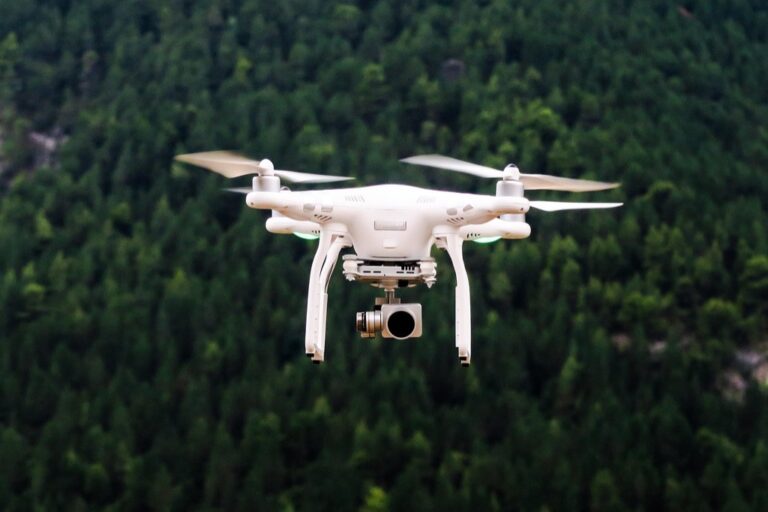
Drone photogrammetry revolutionizes contour mapping through automated aerial image capture and processing. Modern UAV platforms like DJI Phantom 4 RTK and Wingtra One capture high-resolution photos with 1-2cm ground sampling distance. Using specialized flight planning software such as DroneDeploy or Pix4D ensures optimal image overlap (75-80% front lap 60-70% side lap) for accurate 3D reconstruction. Professional-grade drones equipped with RTK/PPK systems achieve absolute accuracy within 2-3cm while covering up to 500 acres per flight at 400ft altitude.
Real-Time Terrain Modeling
Real-time terrain modeling leverages onboard processing units and cloud computing to generate instant topographic data during drone flights. Advanced systems like senseFly’s eMotion software stream live terrain data with accuracy levels of 5cm horizontal and 10cm vertical. Modern drones integrate LiDAR sensors capable of collecting 100 points per square meter even in vegetated areas. Processing platforms such as Propeller PPK and DJI Terra enable instant quality checks and rapid contour generation directly from captured point clouds allowing same-day deliverables for time-sensitive projects.
Capture stunning 4K videos with the DJI Mini 4K's 3-axis gimbal and enjoy stable flight in winds up to Level 5. Its beginner-friendly features include one-tap takeoff/landing and intelligent QuickShots for effortless, professional-quality videos.
Implementing Hybrid Mapping Techniques
Combining Multiple Data Sources
Create comprehensive contour maps by merging diverse data sources including LiDAR point clouds satellite imagery GPS surveys and aerial photographs. Import elevation data from USGS digital elevation models combine it with high-resolution drone imagery and validate using ground control points. Use platforms like Global Mapper or ERDAS IMAGINE to process multiple raster and vector datasets simultaneously achieving accuracy levels of 10-15 cm in complex terrain.
Integrating Different Technologies
Deploy combined technology solutions by linking RTK GPS receivers with mobile LiDAR systems and drone photogrammetry platforms. Connect Trimble R12i GNSS systems to DJI M300 RTK drones equipped with L1 LiDAR sensors for simultaneous ground and aerial data collection. Process the unified datasets through specialized software like TerraSolid or CloudCompare to generate contours with vertical accuracies reaching 3-5 cm in optimal conditions.
| Technology Combination | Typical Accuracy | Coverage Rate |
|---|---|---|
| GPS + LiDAR | 3-5 cm | 50 ha/day |
| Drone + RTK | 2-4 cm | 200 ha/day |
| Multi-sensor | 1-3 cm | 100 ha/day |
Quickly and securely attach your GNSS/GPS equipment with our one-handed quick release adapter, saving you time and reducing instrument damage. Durable aluminum construction ensures a stable connection compatible with R10, R12, R12i receivers and other surveying tools.
Using Emerging Technologies
Modern contour mapping has evolved with breakthrough technologies that provide unprecedented accuracy and efficiency.
3D Laser Scanning Methods
3D laser scanning revolutionizes contour mapping through high-density point cloud collection. Mobile laser scanners like the Faro Focus S350 capture up to 1 million points per second with 1mm accuracy. These systems combine multiple scans to create detailed 3D models perfect for complex terrain mapping. Modern terrestrial laser scanners (TLS) feature built-in GPS integration real-time registration capabilities making them ideal for rapid topographic surveys in challenging environments like urban canyons steep slopes.
AI-Powered Mapping Systems
Artificial intelligence transforms contour mapping through deep learning algorithms that automate feature extraction and elevation modeling. Advanced neural networks like U-Net architecture process satellite imagery and aerial photos to generate contours with 90% accuracy compared to traditional methods. Modern AI platforms such as Microsoft’s TerrainNet incorporate computer vision techniques to identify terrain features detect elevation changes and produce detailed contour maps from various data sources including drone imagery LiDAR scans and historical maps.
Evaluating Cost-Effective Alternatives
Creating professional contour maps doesn’t always require expensive equipment or software. Here’s how to achieve quality results on a budget.
Open-Source Mapping Tools
QGIS stands out as a powerful free alternative to commercial GIS software offering robust contour mapping capabilities. Use GRASS GIS tools within QGIS to generate contours from elevation data with accuracies comparable to paid solutions. SAGA GIS provides specialized terrain analysis modules including contour extraction from DEMs downloaded through public databases like USGS Earth Explorer. These open-source platforms support common file formats letting you import GPS points cloud data LAS files & raster DEMs while offering extensive plugin libraries for enhanced functionality.
Budget-Friendly Survey Methods
Combine smartphone GPS apps like Avenza Maps with handheld clinometers to collect elevation data points for small project areas. Basic RTK GPS receivers paired with free base station networks provide 10-20cm accuracy at a fraction of professional equipment costs. For aerial surveys use entry-level drones like DJI Mini 2 equipped with mapping apps such as DroneDeploy‘s free tier to capture overlapping photos. Process imagery through WebODM an open-source photogrammetry platform that generates point clouds & contours without subscription fees.
Choosing the Right Technique for Your Project
The landscape of contour mapping has evolved significantly with numerous options now available to suit different project requirements and budgets. From high-end LiDAR systems to accessible smartphone apps you’ll find solutions for every scale of mapping project.
Whether you opt for drone-based photogrammetry hybrid approaches or traditional ground surveys the key lies in matching the technology to your specific needs. Consider factors like required accuracy coverage area time constraints and budget when selecting your mapping method.
Your choice of contour mapping technique will shape the efficiency and success of your project. By leveraging these modern alternatives you can create accurate detailed contour maps while optimizing resources and maximizing results.
