8 Ways Culture Influences Map Design: Hidden Stories Behind Global Cartography
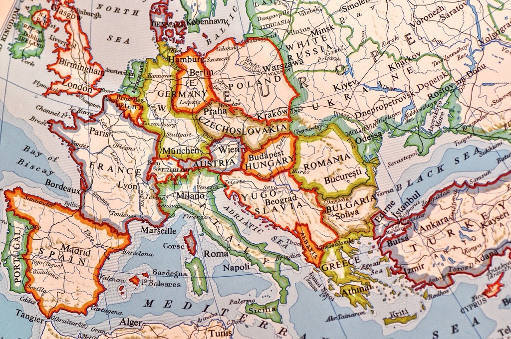
Maps do more than just show us where to go – they tell compelling stories about how different cultures see and interpret their world. When you look at maps from various cultures and time periods you’ll discover fascinating differences in how societies represent space direction and even the meaning they assign to geographical features. These cultural influences in cartography shape everything from color choices and symbol selection to the placement of important landmarks making maps powerful reflections of a society’s values beliefs and ways of understanding their environment.
The way different cultures approach map design reveals deep insights into their worldview and relationship with space. Chinese maps historically placed China at the world’s center while European maps emphasized colonial territories and trade routes – showing how mapmaking serves as a lens into cultural priorities. Understanding these cultural nuances in cartographic design isn’t just academically interesting – it’s essential for creating maps that effectively communicate across diverse global audiences today.
Disclosure: As an Amazon Associate, this site earns from qualifying purchases. Thank you!
Understanding Cultural Cartography Through History
Cultural mapping practices have evolved dramatically across civilizations reflecting each society’s unique worldview spatial understanding and technological capabilities.
P.S. check out Udemy’s GIS, Mapping & Remote Sensing courses on sale here…
Ancient Mapping Traditions
Early civilizations developed distinct approaches to cartography based on their cultural priorities. Babylonian clay tablet maps from 2300 BCE portrayed agricultural lands and water systems reflecting their farming society. Chinese maps like the Yu Ji Tu from 1137 CE placed the imperial palace at the center showcasing their celestial mandate philosophy. Meanwhile Polynesian stick charts mapped ocean swells and currents vital for navigation demonstrating their seafaring expertise.
Evolution of Cultural Map Representations
The transformation of cultural mapping accelerated with increased global interaction. Medieval European mappae mundi placed Jerusalem at the center following Christian worldviews. Islamic cartographers like Al-Idrisi created detailed Mediterranean maps emphasizing trade routes. During the Age of Exploration Western maps shifted to Mercator projections favoring colonial navigation while Japanese maps maintained their unique traditional artistic style until the 19th century. These evolving representations highlight how cultural values technological advances and political powers shaped cartographic traditions.
How Different Cultures Perceive Space and Direction
Spatial perception varies significantly across cultures shaping how different societies understand orient themselves in their environment.
Eastern vs Western Spatial Concepts
Eastern cultures traditionally emphasize relational space where location is defined by connections to landmarks social relationships and natural features. Traditional Chinese maps place the imperial palace at the center with locations radiating outward based on their relationship to the center. Western cultures tend to use absolute coordinate systems grid-based layouts and cardinal directions. This contrast appears in modern navigation where Eastern directions often reference landmarks (“near the temple”) while Western directions use street names and numbers.
Indigenous Mapping Perspectives
Indigenous peoples often incorporate spiritual connections natural features and seasonal patterns into their spatial understanding. Australian Aboriginal songlines map territories through ancestral stories and sacred pathways. Native American tribes use topographical features rivers and celestial patterns as primary reference points. Their maps emphasize the interconnectedness of land resources and cultural heritage rather than precise geometric measurements. Many indigenous maps also include temporal elements showing how landscapes change with seasons and migration patterns.
Cultural Symbols and Color Meanings in Maps
Maps convey cultural meaning through carefully chosen symbols, colors, and decorative elements that resonate with specific audiences.
Religious and Spiritual Symbolism
Religious symbols shape map design across different cultures through distinct visual languages. Islamic maps often feature geometric patterns and avoid human figures while Buddhist maps incorporate dharma wheels and lotus motifs. Christian medieval maps place Jerusalem at the center with crosses and biblical scenes. Hindu maps include sacred rivers like the Ganges and temple locations marked with distinctive spires. These symbols help users connect with maps through familiar spiritual iconography.
Cultural Color Associations
Colors carry different meanings across cultures which impacts effective map design. Red signifies luck in Chinese maps but danger in Western cartography. Islamic maps traditionally use green to represent paradise and sacred spaces. Japanese maps employ blue to indicate temples while European maps use it for water bodies. Understanding these cultural color codes helps create maps that resonate with local audiences and avoid unintended meanings through poor color choices.
Traditional Decorative Elements
Decorative elements reflect cultural artistic traditions in map design. Chinese maps feature cloud motifs and dragon imagery along borders. Persian maps incorporate detailed arabesque patterns and calligraphy. European maps display sea monsters and wind roses in empty ocean spaces. Japanese maps use delicate line work and seasonal imagery like cherry blossoms. These elements transform maps from pure navigation tools into cultural artifacts that preserve artistic heritage.
Learn modern calligraphy and hand lettering with this beginner-friendly guide. It features clear instructions and helpful exercises to develop your skills.
Language and Typography in Cultural Map Design
Language and typography choices significantly impact how different audiences interpret and connect with maps across cultural boundaries.
Script Styles and Writing Systems
Map typography must adapt to diverse writing systems including left-to-right Latin scripts Western alphabets right-to-left Arabic scripts vertical Chinese characters and South Asian abugidas. Each writing system requires specific design considerations for legibility and cultural authenticity. Font selection should honor traditional calligraphic styles while maintaining readability at different scales. For example Japanese maps often use Mincho typefaces for main labels while Arabic maps employ Naskh or Kufi styles that preserve cultural character.
Placement of Text and Labels
Text placement varies significantly based on cultural reading patterns and spatial hierarchies. Western maps typically align text horizontally while East Asian designs may stack characters vertically. Label positioning must respect cultural landmarks religious sites and traditional naming conventions. Critical features like water bodies mountains and settlements need clear hierarchical labeling that aligns with local cultural importance rather than just population or geographic size.
Translation Considerations
Effective map translation requires more than direct word conversion. Place names often carry cultural meanings that need preservation during translation. Names may have multiple accepted versions across languages requiring careful selection based on the target audience. Map designers must consider text expansion or contraction when translating between languages with different character lengths. For example German text typically requires 30% more space than English while Chinese characters are more spatially compact.
Cultural Influences on Map Scale and Projection
Map scale and projection choices reflect deep cultural perspectives about how societies view and represent their world. These technical decisions carry significant cultural implications that shape spatial understanding.
Center Point Selection
Different cultures prioritize distinct center points in their map projections based on their worldview and geopolitical significance. Traditional Chinese maps positioned the imperial capital at the center while Islamic cartographers often centered their maps on Mecca. Modern European and American maps typically use the Prime Meridian as a reference point emphasizing colonial-era conventions. These centering choices reflect cultural power dynamics and shape viewers’ spatial perspective.
Size and Proportion Preferences
Cultural values directly influence decisions about relative sizing and proportional representation in maps. European Mercator projections enlarged colonial territories while diminishing equatorial regions creating a Euro-centric visualization. Japanese maps traditionally emphasized local detail over global scale accuracy reflecting cultural focus on immediate surroundings. Indigenous maps often distort physical distances to highlight culturally significant locations landmarks and trading routes that held greater importance to their communities.
Modern Digital Mapping and Cultural Identity
The digital revolution has transformed mapping from static representations to dynamic interfaces that must respect diverse cultural identities while maintaining global accessibility.
Cultural UX Design Elements
Digital maps now incorporate culturally-aware design elements that enhance user experience across different regions. Map interfaces adapt color schemes based on cultural associations such as using red for prosperity in Chinese markets versus caution in Western contexts. Navigation icons reflect local architectural styles while menu layouts mirror regional reading patterns from right-to-left Arabic scripts to left-to-right Latin text. Modern platforms like Google Maps customize point-of-interest icons to match local cultural symbols creating familiar visual hierarchies for diverse users.
Mobile Map Adaptation
Mobile mapping apps prioritize cultural context in their interface designs for different markets. Apps adjust screen orientations to accommodate vertical text in East Asian languages or right-to-left Arabic scripts. Location-based services customize POI categories to highlight culturally significant places like temples in Thailand or cafes in France. Touch gestures align with local interaction patterns while voice navigation adapts to regional accents dialects. Popular apps like Waze incorporate local holidays traffic patterns cultural events to provide relevant routing information.
Cultural Sensitivity in Contemporary Map Making
Modern cartography demands a thoughtful approach to cultural representation ensuring maps serve diverse global audiences effectively.
Inclusive Design Practices
Digital mapping platforms now implement culturally adaptive interfaces that respond to user preferences and locations. Map makers use flexible design systems to accommodate different writing systems scripts and reading directions. They incorporate culturally relevant landmarks points of interest and local place names. Progressive mapping tools allow customization of symbols colors and typography to match regional expectations while maintaining global accessibility standards. Modern inclusive design also considers various devices screen sizes and accessibility requirements for different user groups.
Addressing Cultural Biases
Map creators actively work to eliminate historical biases in modern cartography through data-driven approaches and diverse representation. They employ alternative map projections that accurately represent land masses and challenge traditional power dynamics. Contemporary mapping platforms use artificial intelligence to detect and flag potentially biased content in maps. Teams of cultural consultants review map elements including place names landmark selection and symbolic representation to ensure respectful portrayal of all communities. Regular user feedback and community engagement help identify and correct unintended cultural misrepresentations in maps.
Future Trends in Cultural Map Design
Emerging technologies and growing cultural awareness are reshaping the future of cartographic design with innovative approaches to representation and accessibility.
AI and Cultural Mapping
AI-powered mapping systems are revolutionizing cultural cartography through real-time cultural adaptation. Machine learning algorithms now analyze user behavior patterns to automatically adjust map displays based on cultural preferences including script direction language icons and color schemes. Advanced neural networks can identify culturally significant landmarks process indigenous knowledge systems and generate culturally appropriate symbology. These AI systems also enable dynamic translation of place names while preserving cultural context and help detect potential cultural biases in map representations.
Preserving Cultural Heritage Through Maps
Digital preservation tools are transforming how we document and protect cultural heritage through interactive mapping platforms. Modern GIS systems now incorporate augmented reality to overlay historical maps with contemporary landscapes creating temporal bridges between past and present cartographic representations. These platforms enable communities to geocode oral histories traditional routes and sacred sites while implementing blockchain technology to verify cultural authenticity. Interactive story maps combine multimedia elements with spatial data to create immersive cultural narratives that engage younger generations in traditional spatial knowledge.
Balancing Universal Design with Cultural Expression
Maps remain powerful tools that shape how you view and interact with the world around you. Understanding cultural influences in map design isn’t just about preserving traditions – it’s essential for creating inclusive and effective cartographic solutions for today’s diverse global audience.
As mapping technologies continue to evolve the challenge lies in striking the right balance between standardization and cultural authenticity. Your awareness of these cultural nuances will help create more meaningful and accessible maps that respect local perspectives while maintaining universal understanding.
The future of cartography depends on embracing both technological innovation and cultural sensitivity. By recognizing and incorporating diverse cultural expressions into map design you’ll contribute to a richer more inclusive cartographic landscape that truly serves all users.
