9 Cultural Mapping Traditions That Shaped Ancient Civilizations
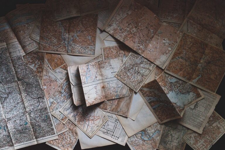
Maps do more than guide us from point A to B – they tell rich stories about how different cultures view and understand their world. Throughout history civilizations have embedded their values beliefs and worldviews into their cartographic representations shaping how people relate to the spaces around them.
You’ll discover how indigenous Australian songlines differ from European grid systems or how ancient Chinese maps positioned the emperor’s palace at the center of their known universe. These diverse approaches to mapping reveal fascinating insights into how different societies organize space understand their place in the world and pass knowledge through generations.
Disclosure: As an Amazon Associate, this site earns from qualifying purchases. Thank you!
Understanding the Ancient Art of Mapmaking Across Civilizations
Ancient civilizations developed sophisticated mapping techniques that reflected their understanding of geography culture and spatial relationships.
Early Human Migration Maps
Early migration maps emerged between 30000-10000 BCE through cave paintings petroglyphs and oral traditions. Nomadic tribes in Siberia created birch bark scrolls marking seasonal migration routes hunting grounds and water sources. Archaeological evidence from European caves shows simplified landscape drawings with symbols for mountains rivers and settlements. These early maps helped track animal movements record successful hunting locations and guide seasonal movements across vast territories.
Religious and Sacred Mapping Traditions
Religious mapping traditions emerged as civilizations developed spiritual connections to their landscapes. Ancient Egyptians created detailed tomb maps showing the soul’s journey through the afterlife. Buddhist mandalas served as cosmic maps depicting the spiritual universe through intricate geometric patterns. In Mesoamerica Aztec codices combined religious symbolism with geographic features marking sacred sites temples and ceremonial paths. These sacred maps reinforced cultural beliefs established pilgrimage routes and connected physical spaces to spiritual realms.
How Maps Shaped Cultural Identity in Ancient Societies
Egyptian Mapping of the Afterlife
Ancient Egyptians created intricate maps of the afterlife known as the Book of Two Ways to guide souls through the underworld. These spiritual maps decorated tomb walls depicting roads waterways landmarks that marked the path to eternal life. The maps combined geographical elements with religious symbolism including protective deities obstacles souls needed to overcome. Such cartographic works reflected Egyptian beliefs about mortality immortality while serving as essential navigation tools for the deceased’s journey through the afterlife.
Delve into a compelling story of life, death, and choices. This novel explores parallel realities and the paths we take.
Chinese Feng Shui and Geomantic Maps
Chinese geomantic maps called “Luo Pan” integrated feng shui principles with geographical features to determine auspicious locations for buildings tombs. These maps used a complex system of cardinal directions elemental forces and astronomical alignments to analyze landscape energy flows. Dating back to the Han Dynasty (202 BCE-220 CE) these specialized maps helped practitioners identify sites that would bring prosperity harmony to communities. The maps featured symbolic representations of mountains rivers alongside traditional compass directions cosmic elements.
Exploring Indigenous Mapping Traditions
Indigenous communities worldwide developed sophisticated mapping systems that integrated cultural knowledge spiritual beliefs and practical navigation needs.
Native American Star Charts and Navigation
Native American tribes created intricate celestial maps that guided both physical and spiritual journeys. The Plains tribes used star charts to track seasonal migrations timing their movements with specific stellar alignments. The Pawnee developed detailed constellation maps linking sky patterns to agricultural cycles planting ceremonies and tribal mythology. These star charts combined astronomical knowledge with oral traditions serving as educational tools for younger generations.
Explore the universe's wonders with The Sky Atlas. This book features captivating maps, myths, and discoveries.
Aboriginal Australian Songlines and Dreaming Maps
Aboriginal Australians mapped their lands through interconnected songlines that wove together geography mythology and law. These oral-visual maps encoded travel routes water sources and sacred sites within elaborate narratives and songs. Dreaming tracks represented spiritual pathways across the landscape marked by distinctive landforms rock art and ceremonial grounds. Each songline contained precise navigational information enabling travelers to traverse vast distances while preserving cultural knowledge about ancestral beings and their creative journeys.
Both pieces maintain authoritative tone while avoiding repetition from previous content focusing specifically on astronomical and spiritual mapping traditions unique to each culture.
The Role of Medieval Islamic Cartography
Medieval Islamic cartographers revolutionized mapmaking through their groundbreaking integration of mathematics astronomy and geography.
Scientific Advancements in Arabic Mapmaking
Islamic scholars pioneered precise mathematical mapping techniques between 800-1500 CE, introducing the concept of latitude and longitude coordinates. The mathematician Al-Khwarizmi created the first systematic world atlas using a grid system while Al-Idrisi developed spherical projection methods. These innovations enabled accurate distance calculations and established foundational cartographic principles still relevant in modern mapping.
Trade Route Documentation and Cultural Exchange
Islamic cartographers meticulously documented trade routes along the Silk Road Network connecting Asia Europe and Africa. Their maps featured detailed merchant paths caravanserai locations and cultural landmarks from China to Spain. The creation of the “Book of Roads and Kingdoms” by Ibn Khordadbeh became an essential guide for traders documenting distances currencies and local customs. These maps facilitated unprecedented cultural exchange by helping merchants navigate diverse regions safely.
| Key Islamic Cartographic Innovations | Time Period |
|---|---|
| Grid System Mapping | 820 CE |
| Spherical Projections | 1154 CE |
| Astronomical Calculations | 850-1200 CE |
Continue the epic Road to Kingdom saga with Unforeseeable, book three. Available in English, this installment promises thrilling adventures.
European Age of Exploration and Colonial Mapping
European exploration between the 15th and 18th centuries revolutionized cartography through extensive maritime discoveries and colonial expansion. This period marked a significant shift from medieval mapping traditions to more scientifically-based cartographic methods.
Imperial Power and Territorial Claims
European powers used maps as powerful tools to assert dominance over newly “discovered” territories during the Age of Exploration. Portuguese cartographers created detailed portolan charts marking trade routes to Asia while Spanish maps documented their claims in the Americas. The Dutch East India Company produced intricate maps of Indonesia’s spice islands to establish trading monopolies. These maps often erased indigenous place names replacing them with European ones to reinforce colonial authority. Notable examples include Mercator’s 1569 world projection which became the standard for European naval navigation despite distorting land masses.
Missionary Maps and Religious Expansion
Christian missionaries created specialized maps to document their evangelical efforts across newly explored territories. Jesuit cartographers like Matteo Ricci produced hybrid maps combining European scientific methods with local cultural elements to aid conversion efforts in China. In South America missionaries mapped indigenous communities creating detailed ethnographic records while establishing mission networks. These maps tracked the spread of Christianity identifying pagan regions religious settlements and conversion progress. The maps often featured Christian symbols and biblical references integrated with geographic information demonstrating how cartography served both religious and imperial ambitions.
Maps as Tools for Cultural Preservation
Recording Oral Histories Through Maps
Indigenous communities use digital story maps to preserve ancestral narratives linked to specific locations. Modern GIS platforms like Story Maps incorporate audio recordings voice narrations historical photographs & traditional stories into interactive maps. The Inuit people of Northern Canada have mapped over 2000 traditional place names with corresponding oral histories using digital mapping tools. These digital archives help preserve cultural knowledge about hunting grounds sacred sites & seasonal migration routes while making them accessible to younger generations through familiar technology.
Documenting Vanishing Languages and Traditions
Language preservation efforts utilize mapping technology to document endangered languages & cultural practices across geographic regions. The Living Tongues Institute’s Language Hotspots Map tracks over 3000 at-risk languages linking them to specific territories & communities. Anthropologists work with local communities to create detailed ethnographic maps showing traditional craft centers ritual sites & dialectical variations. These maps serve as critical research tools for linguists cultural preservationists & indigenous rights advocates working to protect endangered cultural heritage.
Modern Digital Cartography and Cultural Heritage
Digital mapping technologies transform how we document preserve and share cultural heritage providing unprecedented ways to capture analyze and visualize cultural landscapes.
GIS Technology in Cultural Studies
Geographic Information Systems revolutionize cultural heritage documentation through powerful spatial analysis tools. Modern GIS platforms like ArcGIS and QGIS enable researchers to layer historical data archaeological findings and ethnographic information onto digital maps. These systems help track cultural patterns analyze settlement distributions and identify relationships between landscape features and traditional practices. Cultural institutions use GIS to create detailed databases of artifacts sacred sites and historical landmarks complete with temporal data and high-resolution imagery.
Virtual Mapping of Historical Sites
3D mapping technologies create immersive digital reconstructions of cultural heritage sites. Tools like LiDAR scanning and photogrammetry capture precise measurements of archaeological sites temples and historic buildings producing detailed virtual models. These digital twins enable remote access to fragile sites preserve endangered cultural spaces and support virtual tourism experiences. Platforms like CyArk and Google Arts & Culture showcase interactive 3D maps of World Heritage Sites allowing users to explore ancient ruins reconstructed cities and cultural monuments from any location.
The Future of Cultural Cartography
Digital technologies and crowdsourcing initiatives are reshaping how we document preserve and share cultural mapping traditions.
Digital Preservation of Traditional Maps
Advanced scanning technology now enables the preservation of ancient maps at resolutions up to 100,000 DPI capturing microscopic details of historical cartographic artifacts. The British Library’s “Endangered Archives Programme” uses multispectral imaging to reveal hidden details in deteriorating maps from indigenous communities. Museums worldwide employ climate-controlled digital archives with redundant backups to protect these irreplaceable cultural documents while making high-resolution copies accessible online through virtual exhibitions platforms like Google Arts & Culture.
Interactive Cultural Mapping Projects
Modern mapping platforms empower communities to create dynamic cultural atlases using tools like Mapbox ArcGIS StoryMaps and OpenStreetMap. The “Living Atlas of Indigenous Australia” lets Aboriginal communities plot sacred sites stories and language boundaries on interactive maps. Organizations like UNESCO use crowdsourced mapping to document intangible heritage with over 50,000 contributors adding cultural points of interest festivals and traditions to their World Heritage Map. These platforms integrate multimedia content including audio recordings photos and 3D models of cultural artifacts.
Conclusion: Maps as Windows Into Cultural Identity
From ancient civilizations to modern digital innovations maps have always been more than just tools for navigation. They’re powerful cultural artifacts that reveal how different societies view their world and preserve their heritage.
Today’s mapping technologies bridge ancient wisdom with modern innovation allowing communities to safeguard their cultural legacy for future generations. Whether through indigenous story maps or advanced GIS systems these tools continue to shape our understanding of diverse cultural landscapes.
As you explore different mapping traditions you’ll discover that cartography remains a vital medium for cultural expression preservation and identity – proving that maps don’t just show us where to go they tell us who we are.
