9 Ways Satellite Imagery Meets Traditional Cartography To Transform Modern Maps
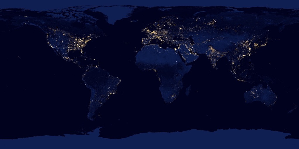
The fusion of satellite imagery with traditional cartography has revolutionized how we understand and visualize our world. Modern mapping techniques now blend time-tested cartographic principles with high-resolution satellite data to create incredibly detailed and accurate representations of Earth’s surface.
You’ll discover how this powerful combination helps urban planners design smarter cities creates more precise navigation systems and enables scientists to track environmental changes with unprecedented accuracy. This marriage of old and new mapping methods isn’t just changing how we make maps – it’s transforming how we interact with and understand our planet.
Disclosure: As an Amazon Associate, this site earns from qualifying purchases. Thank you!
Understanding The Evolution Of Modern Cartography
Traditional Mapping Techniques
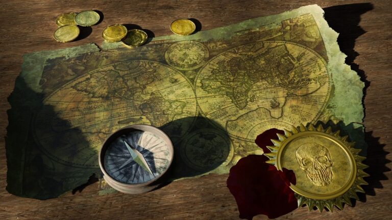
Early cartographers relied on ground surveys triangulation measurements and astronomical observations to create maps. They used tools like compasses theodolites and chains to measure distances angles and elevations. Hand-drawn maps featured detailed symbols contour lines and color coding to represent terrain features settlements and water bodies. These methods required extensive fieldwork mathematical calculations and artistic skill to produce accurate representations of geographic areas. Paper maps remained the primary medium with cartographers developing standardized notation systems for consistent interpretation.
P.S. check out Udemy’s GIS, Mapping & Remote Sensing courses on sale here…
The Rise Of Satellite Technology
The launch of GPS satellites in the 1970s revolutionized mapping capabilities. Modern satellite systems provide high-resolution imagery terrain data and precise positioning information. Earth observation satellites like Landsat SPOT and Sentinel capture multispectral images offering detailed views of land use vegetation patterns and urban development. Digital mapping platforms now process terabytes of satellite data automatically updating maps in real-time. Advanced sensors can penetrate cloud cover detect surface changes and measure elevation with unprecedented accuracy creating detailed 3D terrain models.
Exploring Key Satellite Imagery Technologies
Modern mapping relies on three core satellite-based technologies that work together to create precise geographic data and detailed Earth observations.
Remote Sensing Systems
Remote sensing satellites capture high-resolution images of Earth’s surface using multispectral and radar sensors. These systems collect data across different electromagnetic wavelengths including visible light infrared and microwave frequencies. Leading platforms like Landsat 8 MODIS and Sentinel-2 provide imagery at resolutions from 30cm to 1km per pixel enabling applications in land use monitoring crop health assessment and urban development tracking. Advanced sensors can penetrate cloud cover detect surface temperatures and measure vegetation density.
Understand Landsat 8 data with this comprehensive handbook. It offers detailed explanations of data acquisition, processing, and product specifications, making it an essential resource for remote sensing professionals.
Geographic Information Systems (GIS)
GIS technology integrates processes and analyzes satellite imagery with other geographic data layers. Platforms like ArcGIS QGIS and GRASS GIS combine multiple data sources to create detailed spatial analyses. These systems enable users to overlay satellite imagery with vector data perform advanced spatial calculations and generate custom maps. Modern GIS tools feature machine learning capabilities automated feature extraction and real-time data processing supporting applications from emergency response to environmental conservation.
Master geospatial analysis with GRASS GIS using this comprehensive guide. Learn practical techniques for managing, processing, and visualizing geographic data effectively.
Global Positioning Systems (GPS)
GPS technology provides precise location data through a network of 31 operational satellites orbiting Earth. These satellites broadcast signals that GPS receivers use to calculate their position with accuracy up to 30cm in ideal conditions. Modern GPS systems support applications including precision agriculture autonomous navigation and surveying. Real-time kinematic (RTK) GPS enhances accuracy for professional mapping while assisted GPS (A-GPS) improves performance in urban environments.
Understand the market for RTK precision GPS receivers. This report covers the global outlook for middle and high-level receivers from 2021-2026.
Integrating Traditional Cartographic Elements
Effective integration of traditional cartographic elements enhances the interpretability and usability of satellite-derived maps while maintaining established mapping conventions.
Topographic Features And Contour Lines
Blend satellite elevation data with traditional contour line principles to create detailed terrain representations. Use Digital Elevation Models (DEMs) from satellite sources like SRTM to generate accurate contour intervals at 10 40 or 100-foot spacings. Apply hill shading techniques to enhance topographic visualization while maintaining clear contour line readability. Incorporate hydrographic features like rivers streams and water bodies using both satellite imagery and traditional blue-line representations.
Map Projections And Scale
Select appropriate map projections based on your geographic area and intended use. Apply UTM projections for regional mapping Web Mercator for online applications or custom projections for specific needs. Maintain consistent scale relationships between satellite imagery and vector data using standardized scales like 1:24000 1:50000 or 1:100000. Implement scale bars that automatically adjust when combining multi-resolution satellite imagery with traditional map elements.
Symbol Systems And Legend Design
Design intuitive symbol systems that blend traditional cartographic conventions with satellite-derived features. Use standardized symbols for human-made structures (buildings roads railways) while incorporating custom symbols for features identified from satellite imagery. Create clear hierarchical legends that distinguish between satellite-derived data and traditional map elements. Apply consistent color schemes that enhance readability across both traditional and satellite-based features using industry-standard palettes like those from ColorBrewer.
Leveraging Digital Processing Techniques
Digital processing transforms raw satellite data into usable cartographic information through specialized algorithms and workflows.
Image Enhancement And Correction
Digital enhancement techniques optimize satellite imagery by adjusting contrast ratios brightness levels and color balance. Radiometric correction removes atmospheric distortions while geometric correction aligns images with known ground control points. Advanced tools like ERDAS IMAGINE or ENVI enable precise histogram equalization noise reduction and pan-sharpening operations to merge high-resolution panchromatic data with multispectral imagery achieving optimal visual clarity for mapping applications.
Experience comfortable viewing with reduced blue light emissions and accurate colors thanks to Dell's ComfortView Plus. Enjoy smooth visuals with a 100Hz refresh rate and versatile connectivity with dual HDMI ports.
Data Layer Compilation
Geographic data integration combines satellite imagery with vector layers topographic data and thematic information in a unified coordinate system. Modern GIS platforms like ArcGIS Pro or QGIS facilitate the compilation of multiple data sources through spatial reference standardization. These tools enable seamless overlay of road networks land use classifications administrative boundaries and elevation models creating comprehensive multilayer mapping products.
Spatial Analysis Methods
Spatial analysis transforms raw geographic data into meaningful insights through advanced processing algorithms. Key techniques include kernel density estimation for population distribution mapping supervised classification for land use analysis and digital terrain modeling for watershed delineation. Tools like spatial statistics calculators viewshed analysis and proximity modeling help identify patterns relationships and trends within the integrated satellite and cartographic datasets.
Applying Combined Mapping Solutions
The integration of satellite imagery with traditional cartography creates powerful mapping solutions for diverse applications across multiple sectors.
Urban Planning Applications
Combined mapping solutions revolutionize urban development through detailed spatial analysis and visualization. City planners use high-resolution satellite imagery overlaid with traditional zoning maps to monitor urban sprawl land use changes and infrastructure development. Advanced GIS platforms like ESRI’s ArcGIS Urban enable 3D modeling of cityscapes integrating building footprints transportation networks and population density data. These tools help planners analyze traffic patterns optimize public transportation routes and identify areas for sustainable development.
Environmental Monitoring
Satellite-enhanced mapping systems provide real-time tracking of environmental changes and ecological patterns. Remote sensing data combined with traditional vegetation maps helps monitor forest coverage biodiversity hotspots and habitat fragmentation. Environmental scientists use platforms like Google Earth Engine to analyze temporal changes in ecosystems track natural disasters and assess climate change impacts. The integration of multispectral imagery with ground-truthed data enables precise monitoring of watershed health air quality and coastal erosion.
Natural Resource Management
Modern mapping solutions transform natural resource assessment and sustainable management practices. Resource managers combine satellite-based mineral mapping with geological survey data to identify extraction sites and monitor mining activities. Advanced tools like ENVI and eCognition facilitate the analysis of soil composition water resources and vegetation health. These integrated systems enable better decision-making for resource allocation sustainable harvesting and conservation planning while minimizing environmental impact through precise boundary delineation.
Addressing Technical Challenges
Combining satellite imagery with traditional cartography presents several technical hurdles that require careful consideration and systematic solutions.
Data Resolution Limitations
Satellite imagery resolution constraints can impact map accuracy and detail level. High-resolution images (0.3-0.5m) often come with significant storage demands while medium-resolution data (10-30m) may not capture fine details needed for precise mapping. Platforms like Sentinel-2 offer 10m resolution freely but require trade-offs between coverage area and detail. Using image pyramids and selective high-resolution insets helps balance these limitations with practical mapping needs.
Coordinate System Integration
Merging satellite data with traditional maps requires precise coordinate system alignment. Different satellite platforms use varying coordinate reference systems (CRS) such as WGS84 UTM zones EPSG:32601-32660. Modern GIS tools like QGIS and ArcGIS Pro provide on-the-fly reprojection capabilities but careful attention to datum transformations remains crucial. Organizations must establish standardized projection workflows to maintain spatial accuracy across datasets.
Quality Control Methods
Implementing robust quality control processes ensures reliable integration of satellite and traditional data. Key verification steps include ground control point validation cross-referencing with existing maps and automated error detection algorithms. Tools like ArcGIS Data Reviewer and ERDAS IMAGINE QA module help identify geometric distortions classification errors and projection misalignments. Regular accuracy assessments using standardized metrics like RMSE (Root Mean Square Error) validate final map products.
Implementing Best Practices
Implementing standardized practices ensures consistent high-quality output when combining satellite imagery with traditional cartographic methods.
Workflow Optimization
Establish automated workflows using ModelBuilder in ArcGIS or QGIS graphical modeler to streamline satellite data processing. Configure batch processing for common tasks like image enhancement atmospheric correction & coordinate system alignment. Use version control systems like GeoGit to track changes & enable collaboration among team members. Set up automated quality checks at key processing stages to catch errors early in the workflow.
Data Validation Protocols
Deploy rigorous validation procedures using ground control points (GCPs) to verify spatial accuracy. Check satellite imagery against trusted reference datasets like USGS topographic maps & aerial photographs. Run automated tests for coordinate system alignment geometric distortion & radiometric consistency. Document validation results in standardized reports using tools like ArcGIS Data Reviewer or QGIS validation frameworks.
Output Format Standards
Adhere to industry-standard file formats including GeoTIFF for raster data & shapefile or GeoJSON for vector layers. Maintain consistent resolution settings across project deliverables typically 30cm-1m for urban areas & 2.5m-10m for regional mapping. Export final products with embedded metadata following ISO 19115 standards & include detailed accuracy reports. Structure map layouts using established cartographic hierarchies for optimal visual communication.
Understand ISO 19115 standards with this comprehensive 2020 guide. Get clear explanations and practical examples for effective geospatial metadata management.
Looking Ahead In Modern Cartography
Emerging Technologies
Advanced artificial intelligence and machine learning algorithms are revolutionizing cartographic practices through automated feature extraction and pattern recognition. Deep learning models can now identify roads buildings and land use changes from satellite imagery with 95% accuracy according to recent studies. Real-time processing capabilities enabled by edge computing allow instant updates to map data while augmented reality integration creates interactive 3D visualizations that blend satellite imagery with traditional map elements. Quantum computing developments promise to handle complex spatial analyses that currently take weeks in just minutes.
Future Integration Possibilities
Cross-platform mapping solutions will enable seamless integration between satellite data traditional cartography and emerging technologies. Cloud-based collaborative platforms will allow multiple cartographers to work simultaneously on map products while maintaining version control and quality standards. The integration of Internet of Things (IoT) sensors with satellite imagery will provide real-time environmental monitoring and urban infrastructure mapping. Advanced visualization techniques like holographic displays and brain-computer interfaces will transform how we interact with and understand geographic data creating immersive mapping experiences that combine multiple data sources in intuitive ways.
Conclusion
The fusion of satellite imagery with traditional cartography represents a groundbreaking advancement in how we understand and interact with geographic data. This powerful combination has opened new doors for urban planning environmental monitoring and resource management while setting the stage for future innovations.
As technology continues to evolve you’ll see even more sophisticated mapping solutions emerge. From AI-powered feature detection to immersive 3D visualizations these advancements will further transform how you visualize and analyze geographic information.
The future of cartography lies in seamlessly blending the best of both worlds – combining the precision of satellite data with the intuitive design principles of traditional map-making. This integration will continue to shape how you understand navigate and interact with the world around you.


