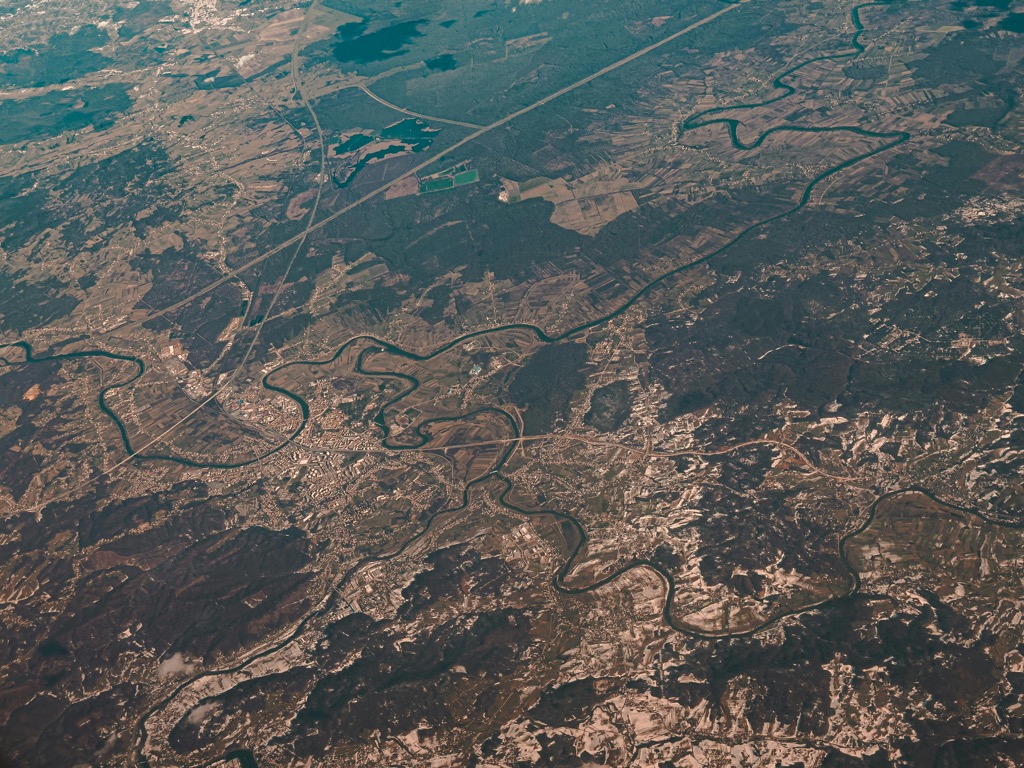
12 Best Remote Sensing Tools for Accurate Terrain Mapping That Improve Precision
In the quest for precise terrain mapping, remote sensing tools have become indispensable. These technologies not only enhance accuracy but also streamline the mapping process, saving you time and resources. Discover the best options available that can elevate your mapping projects to new heights.
Disclosure: As an Amazon Associate, this site earns from qualifying purchases. Thank you!
LiDAR (Light Detection and Ranging)
LiDAR captures high-resolution elevation data and creates detailed 3D terrain models. It’s ideal for dense vegetation areas where traditional methods struggle.
Satellite Imagery
Tools like Landsat and Sentinel provide multispectral imagery, allowing you to analyze land cover and use NDVI (Normalized Difference Vegetation Index) for vegetation assessment.
Aerial Photogrammetry
Software like Pix4D and Agisoft Metashape processes aerial images to generate accurate maps. This method combines visual data with sophisticated algorithms for precise measurement.
Learn survey mapping quickly with the Metashape Pro guide. Master essential photogrammetry techniques step-by-step for accurate 3D model creation.
Digital Elevation Models (DEMs)
DEMs offer a representation of the Earth’s terrain. Tools such as SRTM (Shuttle Radar Topography Mission) provide global coverage, while more localized datasets can enhance detail.
GIS Software
Programs like ArcGIS and QGIS support terrain analysis, allowing you to integrate various data layers for comprehensive mapping projects.
Master ArcGIS Pro 3.2 with this comprehensive guide. Learn essential GIS workflows and data management techniques for effective spatial analysis.
Drones
Equipped with cameras and sensors, drones can quickly gather data over small areas, offering flexibility for precise terrain analysis.
Be mindful of data limitations, such as resolution and accuracy, when using these tools. Incorporating quality assurance/quality control (QA/QC) procedures ensures your mapping projects maintain a high standard, ultimately enhancing the reliability of your outputs.
Overview of Remote Sensing
Remote sensing provides critical insights into the Earth’s surface without direct contact, utilizing various technologies to gather data. Understanding this field is vital for achieving accurate terrain mapping.
Definition of Remote Sensing
Remote sensing is the practice of acquiring information about a target area through the detection of reflected or emitted energy. It employs different technologies, such as satellites, drones, and sensors, to collect and analyze data about the environment. This process enables you to create detailed and accurate representations of the terrain without needing to be physically present.
Importance of Terrain Mapping
Terrain mapping is essential for various applications, including urban planning, environmental monitoring, and resource management. By utilizing remote sensing technologies, you can achieve high precision and efficiency in mapping efforts, which helps save time and resources. Accurate terrain maps facilitate informed decision-making, disaster management, and land use planning, ultimately enhancing the effectiveness of projects across numerous sectors.
Top Satellite-Based Remote Sensing Tools
When tackling the challenge of accurate terrain mapping, selecting the right remote sensing tools is essential. Here are some of the most effective satellite-based tools to enhance your mapping projects.
Landsat Series Satellites
Landsat satellites, launched in 1972, have been instrumental in collecting high-resolution images of Earth’s surface. They provide data with a 30-meter resolution and capture multispectral data, which is invaluable for land cover classification and change detection. Using Landsat data, you can reliably assess vegetation health, urban expansion, and water resource management. Their free availability under the USGS makes them a go-to resource for many mapping projects.
Sentinel Satellites
Sentinel satellites, part of the European Space Agency’s Copernicus program, offer a sophisticated suite of Earth observation tools. With various satellites, like Sentinel-2, they provide multispectral imagery with a resolution of 10 to 60 meters, perfect for monitoring vegetation, soil, and water. The Sentinel-1 satellite, utilizing synthetic aperture radar (SAR) technology, excels in detecting changes in land usage and elevation. Their data accessibility through the Copernicus Open Access Hub supports rigorous analysis and applications in multiple sectors.
WorldView Satellites
WorldView satellites, operated by Maxar Technologies, stand out for their commercial high-resolution imaging capabilities. WorldView-3 offers a remarkable 31-centimeter resolution, delivering detailed perspectives essential for urban planning, infrastructure monitoring, and disaster management. These satellites capture multi-spectral imagery, allowing for rich analyses of the terrain. However, note that access to WorldView data typically requires a purchase, making it a valuable investment for projects demanding precision and detail.
Leading Airborne Remote Sensing Tools
Accurate terrain mapping can often seem daunting. You might struggle with integrating complex data sources, ensuring precision, and creating visually impactful maps that communicate insights effectively.
Establishing the Technical Context
Modern mapping requires a blend of technology, techniques, and practical applications. To navigate this landscape, you must understand the various tools and methods available, each serving specific needs in the mapping process.
Key Methods and Tools
LiDAR Systems
LiDAR (Light Detection and Ranging) stands out for producing detailed 3D models. It collects data effectively under varying conditions, boasting an impressive vertical accuracy with RMSE values as low as 0.174 meters, barring dense vegetation interference. This makes it invaluable for precision elevation models and vegetation analysis.
Aerial Photogrammetry
Aerial photogrammetry uses high-resolution photographs taken from aircraft or drones to create 3D maps. This method allows you to capture surface features with precision. Tools like Agisoft Metashape or Pix4Dmapper facilitate this process, enabling you to generate orthophotos and digital elevation models.
Hyperspectral Imaging
Hyperspectral imaging captures data at various wavelengths beyond the visible spectrum. This technology helps in classifying materials based on their spectral signatures. For instance, sensors like the HySpex systems can be utilized in agricultural monitoring or mineral exploration, providing detailed insights into land cover variability.
Addressing Common Technical Issues
One persistent issue is ensuring data quality. Always verify your sources—using well-established databases or commercial satellite imagery is essential. Implementing QA/QC procedures, such as cross-referencing data with ground truth observations, aids in maintaining accuracy.
Exploring Data Visualization Options
Effective data visualization bridges that gap between complex data and user comprehension. Use tools like Tableau or ArcGIS StoryMaps to create interactive visualizations that engage your audience and communicate findings effectively.
Providing Workflow Frameworks
Establishing a structured workflow is crucial for efficient mapping projects. Following a systematic approach—data collection, processing, analysis, and visualization—can help streamline your efforts. Utilizing project management tools like Trello or Asana can keep your projects organized.
Quality Control Tips
In mapping, accuracy is paramount. Regularly review your datasets and outputs. Implementing version control with tools like Git can ensure you track changes and maintain document integrity throughout your projects.
Your journey in terrain mapping can be equipped with the right techniques and tools. By focusing on accuracy, usability, and clear communication, you can create maps that not only serve their purpose but also resonate with your audience.
Popular Ground-Based Remote Sensing Tools
When tackling the complexities of accurate terrain mapping, employing ground-based remote sensing tools can significantly enhance your efficiency and data quality. Below are some of the most effective options available.
Total Station Instruments
Total stations are crucial for high-precision surveying. They combine an electronic theodolite and an electronic distance meter (EDM), enabling you to measure horizontal and vertical angles along with distances. Their strengths include:
- High accuracy: Achieve precise measurements, often within a millimeter.
- Speed: Conduct surveys faster than traditional methods, often with a single operator.
- Versatility: Use them for various tasks, such as measuring ground levels, road markings, and features at height.
GPS Survey Equipment
GPS survey equipment is essential for collecting geospatial data with global coverage. By leveraging satellite signals, you can achieve accuracy at both the metric and centimeter levels. Consider the following features:
- Real-time kinematic (RTK) positioning: Attain centimeter-level accuracy in real-time.
- Versatility: Utilize GPS for various applications, including boundary determination and infrastructure monitoring.
- Integration: Combine GPS data with GIS software for advanced spatial analysis.
- Resolution: Choose between high-resolution (1 meter or less) and medium-resolution (30 meters) DEMs depending on project needs.
- Applications: Use DEMs for flood modeling, land use planning, and environmental analysis.
- Data sources: Gather DEMs from satellite imagery, LiDAR surveys, and public repositories like the National Elevation Dataset (NED).
Emerging Technologies in Remote Sensing
Emerging technologies are transforming remote sensing, enhancing the accuracy and efficiency of terrain mapping. These formats offer innovative solutions to traditional mapping challenges, providing you with tools to achieve high-resolution results.
UAVs and Drones for Terrain Mapping
UAVs and drones are revolutionizing terrain mapping by providing flexible, high-resolution data collection options. These aircraft can access areas difficult to reach, capturing detailed imagery for accurate topographic maps. For example, the DJI Matrice 300 RTK drone integrates real-time kinematic (RTK) positioning, allowing for centimeter-level accuracy in mapping projects. This precision is invaluable for applications in forestry management and land surveying, where detail is critical. By utilizing advanced cameras and sensors, such as the Zenmuse P1, you can generate precise orthomosaics and digital elevation models efficiently.
Capture stunning 4K HDR video with this lightweight drone, perfect for social media with its True Vertical Shooting mode. It offers stable footage in windy conditions thanks to its 3-axis gimbal and features beginner-friendly controls like GPS Return to Home.
Machine Learning Applications in Remote Sensing
Machine learning applications are streamlining data analysis in remote sensing, enabling quicker decision-making. Techniques like convolutional neural networks (CNN) can enhance land cover classification, automating the identification of features in satellite imagery. For instance, Google Earth Engine utilizes machine learning to analyze vast datasets rapidly, making it an essential tool for monitoring vegetation health and urban growth patterns. By integrating machine learning workflows, you can improve the accuracy of terrain mapping while minimizing human error, ultimately leading to more reliable outputs.
Conclusion
Investing in the right remote sensing tools is crucial for achieving accurate terrain mapping. By leveraging technologies like LiDAR, satellite imagery, and drones, you can enhance the precision and efficiency of your mapping projects. Remember to incorporate quality assurance measures to maintain high standards and ensure reliability in your outputs.
As you explore these tools, consider the specific needs of your project and the challenges you may face. The right combination of technology and techniques can significantly improve your mapping results and facilitate informed decision-making across various applications. Embrace the advancements in remote sensing to elevate your terrain mapping efforts to new heights.


