7 Ways Technology Transforms Collaborative Map-Making Today
Digital technology has revolutionized how we create, share and interact with maps, transforming what was once a solitary cartographer’s task into a dynamic collaborative effort. From OpenStreetMap’s global community of volunteers to Google Maps’ real-time traffic updates, collaborative map-making has become an essential part of our daily navigation and spatial understanding. This democratization of cartography through technological advances isn’t just changing how maps are made – it’s reshaping our relationship with geographic information and enabling communities to document their world in unprecedented ways.
Social mapping platforms and crowdsourced geographic data have created a new era where your local knowledge can contribute to a global understanding of our world. Whether you’re marking a new bike trail, updating business information or mapping disaster relief routes you’re now part of a worldwide network of digital cartographers shaping how we visualize and navigate our planet.
Disclosure: As an Amazon Associate, this site earns from qualifying purchases. Thank you!
How Digital Tools Revolutionized Traditional Map Creation
From Paper Maps to Digital Interfaces
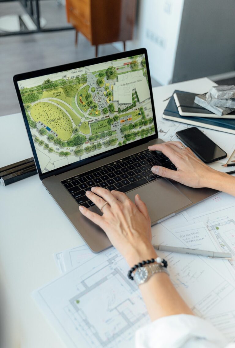
Digital tools transformed map creation from manual drafting to dynamic computer-based design during the 1990s. Cartographers switched from ink pens and mylar sheets to Computer-Aided Design (CAD) software that enabled precise measurements and easy edits. Modern mapping platforms like Adobe Illustrator and Mapbox now offer drag-and-drop interfaces intuitive editing tools and custom styling options. These digital interfaces allow mapmakers to create update and share maps in hours instead of the weeks required for traditional methods.
P.S. check out Udemy’s GIS, Mapping & Remote Sensing courses on sale here…
Create durable, reusable stencils with these sturdy 7.5Mil mylar sheets. Food-safe and compatible with cutting machines, they're ideal for crafting, baking, and various DIY projects.
The Rise of Geographic Information Systems (GIS)
Geographic Information Systems revolutionized spatial data management by introducing layered mapping architecture in the 1960s. ESRI’s ArcGIS and open-source QGIS now enable users to analyze multiple data sets simultaneously combine satellite imagery with vector data and perform complex spatial calculations. Modern GIS platforms process massive datasets from GPS trackers environmental sensors and demographic surveys to generate detailed interactive maps. This technology transforms raw geographic data into actionable insights for urban planning environmental monitoring and business intelligence.
Understanding Collaborative Mapping Platforms
Modern mapping platforms have transformed cartography into a community-driven endeavor where millions of users contribute to creating detailed digital maps.
OpenStreetMap and Crowdsourced Data
OpenStreetMap (OSM) revolutionizes cartography through its wiki-style approach to map creation. Users contribute geographic data by tracing satellite imagery mapping roads buildings and points of interest. The platform’s open-source nature allows free access to raw geodata which powers humanitarian mapping projects disaster response efforts and local community initiatives. OSM’s global community validates edits ensuring data accuracy while specialized tools like iD Editor and JOSM enable efficient mapping workflows.
Google Maps’ Contribution Features
Google Maps enhances collaborative mapping through Local Guides program and user contributions. Contributors earn points by adding reviews photos business information and real-time updates. The platform’s Road Editor tool enables users to report map inaccuracies suggest edits and add missing places. Machine learning algorithms verify submissions while the Google Maps app automatically collects anonymous traffic data from millions of users to provide accurate navigation information.
The Role of Mobile Technology in Map Creation
Mobile devices have revolutionized collaborative map-making by turning every smartphone user into a potential cartographer.
GPS-Enabled Devices and Real-Time Updates
GPS-enabled smartphones now serve as powerful mapping tools with centimeter-level accuracy. These devices collect real-time location data while users move recording tracks paths & points of interest automatically. Modern phones combine GPS with accelerometers & gyroscopes to improve positioning accuracy even indoors. Apps like Mapillary & OpenStreetCam let users capture street-level imagery that updates map features instantly through machine learning detection.
Create a lush, low-maintenance landscape with the Miyawaki Method using UOL A 621. This blend of native seeds helps you quickly establish a dense, biodiverse forest in a small area, promoting ecological restoration.
Location-Based Services Integration
Map creation now integrates seamlessly with location-based services through APIs & SDKs. Popular mapping platforms offer tools that tap into device sensors to gather contextual data like altitude business hours & crowd levels. Services like Foursquare Places API & Google Places SDK enable automated venue discovery & validation. This integration helps maintain updated points of interest with minimal manual input while ensuring data accuracy through cross-referencing multiple sources.
Learn geolocation with PHP using this guide! Explore Foursquare-API, Google Places, and Qype integration for location-based applications.
Social Elements of Digital Map Collaboration
Modern collaborative mapping thrives on social interaction and community involvement creating a dynamic ecosystem of shared geographic knowledge.
Community-Driven Map Editing
Map enthusiasts form vibrant editing communities on platforms like OpenStreetMap where they coordinate large-scale mapping projects. Local mappers contribute detailed knowledge of their neighborhoods while subject matter experts validate complex features like transit routes or land use classifications. These communities organize mapping parties hackathons and virtual mapathons to tackle specific geographic areas or themes. Popular editing tools like iD Editor JOSM and Maps.me enable contributors to map from browsers phones or desktop applications with built-in validation rules.
Verification and Quality Control Systems
Digital mapping platforms employ multi-layered verification systems to maintain data accuracy. OpenStreetMap uses changeset discussions peer reviews and automated validation tools to catch common errors. Google Maps combines AI-powered verification machine learning algorithms and human moderators to assess contributed content. Quality metrics track edit histories contributor reputation scores and community validation rates. These systems flag suspicious patterns cross-reference multiple data sources and enable rapid correction of inaccurate information through established dispute resolution processes.
Artificial Intelligence in Modern Cartography
Artificial Intelligence revolutionizes map-making through automated processes and intelligent data analysis, transforming traditional cartographic workflows into sophisticated digital systems.
Machine Learning for Map Generation
Machine learning algorithms now generate detailed maps from satellite imagery using neural networks trained on millions of geographic data points. These systems analyze patterns to create accurate road networks, identify building footprints and classify land use with 95% accuracy. Popular platforms like Mapbox and Google Maps leverage deep learning models to automatically generate map features from aerial photographs eliminating weeks of manual digitization work. The technology excels at identifying complex patterns like road intersections building densities and natural boundaries across diverse landscapes.
Automated Feature Detection
AI-powered feature detection systems scan satellite imagery to identify and classify map elements in real-time. Computer vision algorithms can detect changes in infrastructure spot new construction and update map features without human intervention. Modern mapping platforms use convolutional neural networks to recognize objects like traffic signs buildings and vegetation with precision rates exceeding 90%. These systems process thousands of images per hour enabling rapid map updates across global regions while maintaining consistent quality standards through automated validation checks.
Impact on Professional Cartography
Changing Role of Traditional Mapmakers
Traditional cartographers have evolved from manual drafters to digital data specialists. Modern mapmakers now combine classical cartographic principles with advanced technology skills including GIS software proficiency database management and programming. Their work has shifted from creating static maps to managing dynamic geographic databases deploying web-based mapping solutions and overseeing automated processes. Rather than working in isolation cartographers now collaborate with software developers data scientists and community contributors to produce interactive mapping products.
Master ArcGIS Pro 3.2 with this comprehensive guide. Learn essential GIS workflows and data management techniques for effective spatial analysis.
New Career Opportunities in Digital Mapping
The digital transformation has created diverse career paths in cartography. New roles include GIS analysts who process spatial data digital cartographic designers who create custom map styles and mapping platform developers who build collaborative tools. Opportunities have emerged in specialized fields like 3D terrain modeling real-time navigation systems and location-based services. Tech companies startups and government agencies actively recruit professionals with combined expertise in traditional cartography digital workflows and modern mapping technologies like machine learning and augmented reality.
Democratization of Geographic Information
Breaking Down Access Barriers
Digital platforms have eliminated traditional barriers to geographic information access by providing free mapping tools and data. OpenStreetMap enables anyone with internet access to view detailed maps modify cartographic data and contribute local knowledge. Professional GIS software companies like Esri now offer free educational licenses web-based tools and mobile apps making advanced mapping capabilities accessible to students researchers and hobbyists. Cloud-based platforms such as Mapbox and CARTO allow users to create customize and share interactive maps without expensive hardware or software investments.
Empowering Local Communities
Local communities now leverage collaborative mapping tools to document their neighborhoods advocate for change and respond to emergencies. Indigenous groups use participatory mapping to preserve cultural heritage and defend land rights while urban communities create detailed street-level maps highlighting accessibility issues and safety concerns. Humanitarian organizations coordinate disaster response through platforms like HOT OSM where volunteers worldwide rapidly map affected areas. Community-driven projects enable residents to map resources like urban gardens local businesses and cultural landmarks creating rich geographic datasets that reflect local knowledge and needs.
Challenges and Future Considerations
Data Privacy and Security Concerns
Collaborative map-making raises significant privacy concerns as users contribute location data and personal information. Platforms must balance data accessibility with user privacy protecting sensitive information like private residences home addresses. Location tracking features in mapping apps create potential security risks requiring robust encryption protocols and clear data handling policies. Major platforms now implement strict access controls data anonymization techniques and compliance with regulations like GDPR while allowing necessary information sharing for map accuracy.
Maintaining Mapping Accuracy at Scale
Large-scale collaborative mapping faces increasing accuracy challenges as contributor numbers grow exponentially. Platforms employ multi-tiered validation systems combining AI verification community review and expert oversight to maintain data quality. Automated tools flag suspicious edits while machine learning algorithms detect mapping patterns to identify potential errors. Quality metrics track contributor reliability edit histories and validation rates enabling quick identification of inaccurate submissions. OpenStreetMap and Google Maps utilize trust scores verification workflows and dispute resolution systems to balance rapid updates with mapping precision.
How Technology Shapes Future Map-Making
Emerging Technologies in Cartography
Augmented Reality (AR) platforms transform map visualization by overlaying digital information onto physical environments. Machine learning algorithms now process satellite imagery 85% faster than manual methods while achieving 95% accuracy in feature detection. Advanced drone mapping systems capture high-resolution terrain data with 2cm precision enabling 3D terrain modeling for infrastructure planning. Quantum computing applications promise to revolutionize spatial analysis by processing complex geographic calculations instantly while blockchain technology ensures data authenticity through immutable location records.
Predictions for Collaborative Mapping
Real-time collaborative mapping will expand through 5G networks enabling instant map updates from millions of IoT sensors. Cross-platform integration will connect diverse mapping services through standardized APIs allowing seamless data sharing between OpenStreetMap Google Maps and specialized mapping platforms. AI-powered validation systems will automatically verify 90% of map edits reducing the need for manual review. Decentralized mapping networks will emerge using blockchain to create trusted geographic databases while protecting contributor privacy through encrypted submissions.
Conclusion: The Future of Digital Collaborative Mapping
Digital technology has fundamentally reshaped how we create explore and interact with maps. The fusion of AI machine learning and community participation has transformed cartography from an individual pursuit into a dynamic collaborative endeavor.
As mapping platforms continue to evolve you’ll see even more innovative features that blend AR capabilities real-time updates and enhanced data verification systems. These advancements won’t just improve map accuracy – they’ll revolutionize how you understand and navigate your world.
The future of collaborative mapping lies in your hands. Whether you’re a casual contributor or a dedicated cartographer you’re now part of a global community that’s constantly refining our shared geographic knowledge. This democratized approach to cartography ensures that maps will keep evolving to meet your changing needs.


