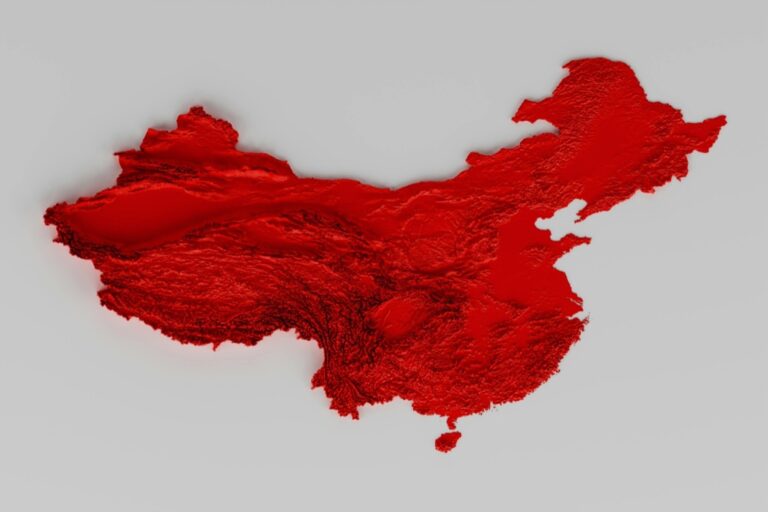
9 Techniques for Creating 3D Terrain Maps That Transform Digital Landscapes
Creating stunning 3D terrain maps doesn’t have to be a complex endeavor when you understand the right techniques and tools at your disposal. From photogrammetry to LiDAR scanning and digital elevation models (DEM), modern mapping technologies offer diverse approaches to transform flat data into immersive three-dimensional landscapes.
Whether you’re a cartographer, game developer, or environmental scientist, mastering these terrain mapping techniques can elevate your projects to new heights. You’ll discover how combining traditional mapping methods with cutting-edge digital tools can help you create accurate, visually compelling 3D representations of any landscape on Earth.
Disclosure: As an Amazon Associate, this site earns from qualifying purchases. Thank you!
Understanding the Basics of 3D Terrain Mapping
Creating accurate 3D terrain maps requires understanding fundamental principles and working with specific datasets to represent elevation changes effectively.
Key Elements of Digital Elevation Models
Digital Elevation Models (DEMs) contain three essential components that form the foundation of 3D terrain mapping. The raster grid structure stores elevation values in a matrix format with consistent cell spacing. Height values represent the vertical distance from a reference point like sea level. Spatial resolution determines the ground distance between data points affecting map detail level. Advanced DEMs also include additional attributes such as slope angles surface roughness and drainage patterns to enhance terrain visualization.
Essential Software and Tools
The core toolkit for 3D terrain mapping includes specialized GIS platforms terrain modeling software and data processing tools. QGIS and ArcGIS Pro offer comprehensive DEM manipulation capabilities with built-in 3D visualization features. Specific terrain modeling tools like Terragen and World Machine enable detailed landscape creation and texturing. For processing raw elevation data GlobalMapper and LAStools handle point cloud conversion while Blender supports advanced 3D modeling and rendering operations. Cloud-based solutions like Cesium offer web-compatible 3D terrain visualization options.
Create stunning 3D terrain quickly and easily with World Machine. Design realistic landscapes using powerful tools for erosion, texturing, and advanced sculpting.
Soothe and protect sensitive skin with this gentle, natural ointment. Made in the USA with organic beeswax, cedarwood, and jojoba oil, this paraben-, alcohol-, and dye-free formula provides therapeutic relief.
Creating Terrain Maps Using Digital Elevation Data
Digital elevation data serves as the foundation for creating detailed 3D terrain maps through various processing methods and data sources.
Working With SRTM and ASTER Data
SRTM (Shuttle Radar Topography Mission) and ASTER (Advanced Spaceborne Thermal Emission and Reflection Radiometer) provide global elevation datasets at 30-meter resolution. Access these datasets through USGS Earth Explorer or NASA’s Earthdata portal. Convert the downloaded files to GeoTIFF format using GDAL tools for compatibility with most GIS software. Remove data voids through interpolation techniques in QGIS or ArcGIS Pro to ensure seamless terrain representation.
Master ArcGIS Pro 3.2 with this comprehensive guide. Learn essential GIS workflows and data management techniques for effective spatial analysis.
Explore Earth like never before with Spectacular Earth! This book features stunning, high-resolution satellite images from the USGS, revealing our planet's beauty and dynamic landscapes.
Processing LiDAR Point Clouds
LiDAR point clouds offer highly detailed terrain data with sub-meter accuracy. Use LAStools or CloudCompare to classify ground points and remove noise from raw LiDAR data. Convert the filtered point cloud to a Digital Elevation Model (DEM) using ground point interpolation methods like IDW or TIN. Optimize processing speed by tiling large datasets into manageable chunks and batch processing them through automated workflows in Python or model builder tools.
Explore the accuracy of Apple LiDAR for 3D surveying in field sciences. This Japanese edition focuses on physiognomies and volumes of 3D targets.
Photogrammetry Techniques for Terrain Modeling
Photogrammetry transforms overlapping aerial photographs into detailed 3D terrain models through advanced image processing algorithms.
Aerial Photography Processing
Create accurate terrain models using specialized photogrammetry software like Agisoft Metashape or Pix4D Mapper. Start by importing multiple overlapping aerial photos with at least 60% front overlap and 30% side overlap. Process the images through automatic tie point detection to establish ground control points. Generate dense point clouds by matching features across images then convert them to mesh models. Enhance accuracy by incorporating GPS data and camera calibration parameters.
Learn survey mapping quickly with the Metashape Pro guide. Master essential photogrammetry techniques step-by-step for accurate 3D model creation.
Drone Mapping Solutions
Deploy consumer or professional drones equipped with high-resolution cameras to capture terrain data at various altitudes. Use automated flight planning apps like DJI GS Pro or DroneDeploy to ensure consistent image overlap and coverage. Program optimal flight paths with cross-grid patterns at 200-400 ft elevation for maximum detail. Process captured images through cloud-based platforms like OpenDroneMap or WebODM to generate orthorectified maps DEMs and 3D models ready for GIS integration.
Manual Terrain Modeling Approaches
Traditional hands-on techniques remain valuable for creating custom 3D terrain maps especially for specialized projects requiring artistic interpretation or physical displays.
Traditional Clay and Physical Modeling
Physical terrain modeling using clay or foam materials offers unique tactile control for creating detailed landforms. Start by building a base structure using plywood or foam board scaled to your project specifications. Layer modeling clay in 1-inch increments following contour lines from topographic maps keeping precise measurements with calipers. Add texture using specialized tools like rubber sculpting implements dental picks or patterned rollers to represent different surface features. This method excels for museum displays educational models or architectural presentations requiring tangible 3D representations.
Digital Sculpting Methods
Digital sculpting software like ZBrush Mudbox or Blender provides precise control for creating terrain details without physical materials. Begin by importing a base heightmap then use pressure-sensitive brushes to sculpt elevation changes valleys ridges and erosion patterns. Apply dynamic tessellation to increase mesh density in areas needing fine detail. Utilize alphas and custom brushes to create realistic rock formations cliff faces or river channels. Export your sculpted terrain as displacement maps for integration with GIS software or game engines while maintaining high-resolution surface details.
Procedural Generation of 3D Terrains
Procedural generation offers automated methods to create realistic terrain features through algorithmic processes rather than manual modeling.
Using Height Maps and Noise Algorithms
Height maps serve as the foundation for procedural terrain generation by using grayscale images where pixel values represent elevation. Perlin noise and fractal algorithms create natural-looking landscapes by combining multiple noise frequencies. Tools like World Machine and Gaea let you stack noise layers with different octaves amplitudes and frequencies to generate varied terrain features from mountains to valleys. Modern engines like Unity and Unreal provide built-in noise functions to generate infinite procedural terrains in real-time.
Erosion Simulation Techniques
Hydraulic and thermal erosion algorithms simulate natural weathering processes to add realism to procedural terrains. Hydraulic erosion mimics water flow patterns by calculating material displacement detecting water accumulation points and creating drainage networks. Popular tools like Houdini TerrainFX and World Machine‘s erosion nodes use particle systems to simulate rainfall sediment transport and deposition. The simulation parameters let you control erosion intensity weathering patterns and material hardness to achieve different landscape characteristics.
Combining Multiple Data Sources
Creating comprehensive 3D terrain maps often requires integrating different data types to achieve optimal accuracy and detail.
Merging Satellite and Ground Data
Combine high-resolution satellite imagery with ground-based measurements to create detailed terrain models. Import SRTM data for broad elevation coverage then enhance it with LiDAR point clouds or GPS survey points for precise local details. Use tools like Global Mapper or QGIS to merge these datasets through spatial joins and interpolation techniques. Validate elevation accuracy by cross-referencing overlapping areas between different data sources.
Integrating Vector and Raster Information
Layer vector data like contour lines property boundaries and infrastructure over raster-based elevation models to add context to your 3D terrain. Convert vector features to 3D using elevation values from your DEM then drape high-resolution orthophotos over the surface for realistic visualization. Tools like ArcGIS Pro and SAGA GIS offer specialized functions for combining vector and raster data while maintaining spatial accuracy and proper georeferencing.
Advanced Rendering and Visualization Methods
Creating professional 3D terrain maps requires mastering advanced visualization techniques to achieve photorealistic results and enhance map readability.
Texturing and Material Application
Apply realistic textures to your terrain using satellite imagery or procedural materials. Create custom texture maps in software like Substance Designer to represent different surface types such as rock grass or snow. Use UV mapping techniques to properly align textures with terrain features avoiding stretching or distortion. Implement texture blending masks based on elevation slope or aspect data to achieve natural transitions between different surface materials.
Lighting and Shadow Techniques
Configure multiple light sources to create depth and emphasize terrain features through shadows. Set up a main directional light to simulate sunlight with appropriate intensity and color temperature between 5000-6500K. Add ambient occlusion to enhance depth perception in valleys and crevices. Implement real-time shadows with cascade shadow mapping for dynamic visualization or bake shadow maps for static terrain views. Use rim lighting to highlight ridgelines and terrain silhouettes.
Real-Time Terrain Generation
Real-time terrain generation enables dynamic creation and rendering of 3D landscapes as users explore virtual environments. This technique is crucial for applications like video games flight simulators and interactive mapping platforms.
Dynamic Level of Detail Systems
Level of Detail (LOD) systems optimize terrain rendering by adjusting mesh complexity based on camera distance. Close terrain areas display high-resolution meshes with detailed features while distant regions use simplified geometries. Tools like Unity’s terrain engine and Unreal Engine’s landscape system implement automatic LOD transitions using quad-tree structures. These systems maintain frame rates by loading only necessary detail levels within the viewer’s frustum.
Optimization Strategies
Implement chunk-based loading to stream terrain data efficiently by dividing landscapes into manageable tiles. Use GPU tessellation to dynamically adjust mesh density perform frustum culling to skip rendering unseen terrain segments and cache frequently accessed terrain chunks. Popular engines like CryEngine and OGRE3D offer built-in terrain optimization features including texture atlasing normal map compression and geometry instancing. These techniques reduce memory usage while maintaining visual quality at various distances.
Post-Processing and Enhancement
After generating your base 3D terrain model essential post-processing steps enhance realism and visual appeal.
Adding Environmental Details
Enrich your terrain maps with vegetation layers using specialized tools like SpeedTree or Vue xStream. Add water bodies by applying realistic water shaders and reflective materials. Place 3D models of trees rocks and buildings using automated distribution tools in software like Terragen or World Machine. Incorporate atmospheric effects such as fog volumetric clouds and particle systems to create depth. Use heightmap-based vegetation masks to control foliage distribution based on elevation slope and aspect.
Improving Visual Quality
Apply ambient occlusion to add depth to terrain crevices and valleys using tools like SSAO in Unity or built-in AO in Unreal Engine. Enhance material definition with physically-based rendering (PBR) textures including normal maps roughness maps and displacement maps. Implement anti-aliasing techniques like MSAA or FXAA to smooth jagged edges. Adjust color grading and post-processing effects such as bloom HDR and depth of field to create atmosphere. Use terrain-specific shaders for features like snow accumulation and wetness based on elevation and slope angles.
Best Practices for 3D Terrain Mapping
Creating stunning 3D terrain maps is now more accessible than ever with the wide range of techniques and tools available. Whether you’re using photogrammetry LiDAR data or procedural generation you’ll find that each method offers unique advantages for different mapping scenarios.
The key to successful terrain mapping lies in choosing the right combination of techniques for your specific needs. You’ll get the best results by leveraging multiple data sources and applying appropriate post-processing techniques to enhance visual quality.
Remember that technical expertise combined with artistic vision will help you create the most compelling 3D terrain visualizations. As mapping technology continues to evolve you’ll find even more innovative ways to bring landscapes to life in three dimensions.


