9 Mapping The Uncharted: New Territories That Transform Digital Discovery
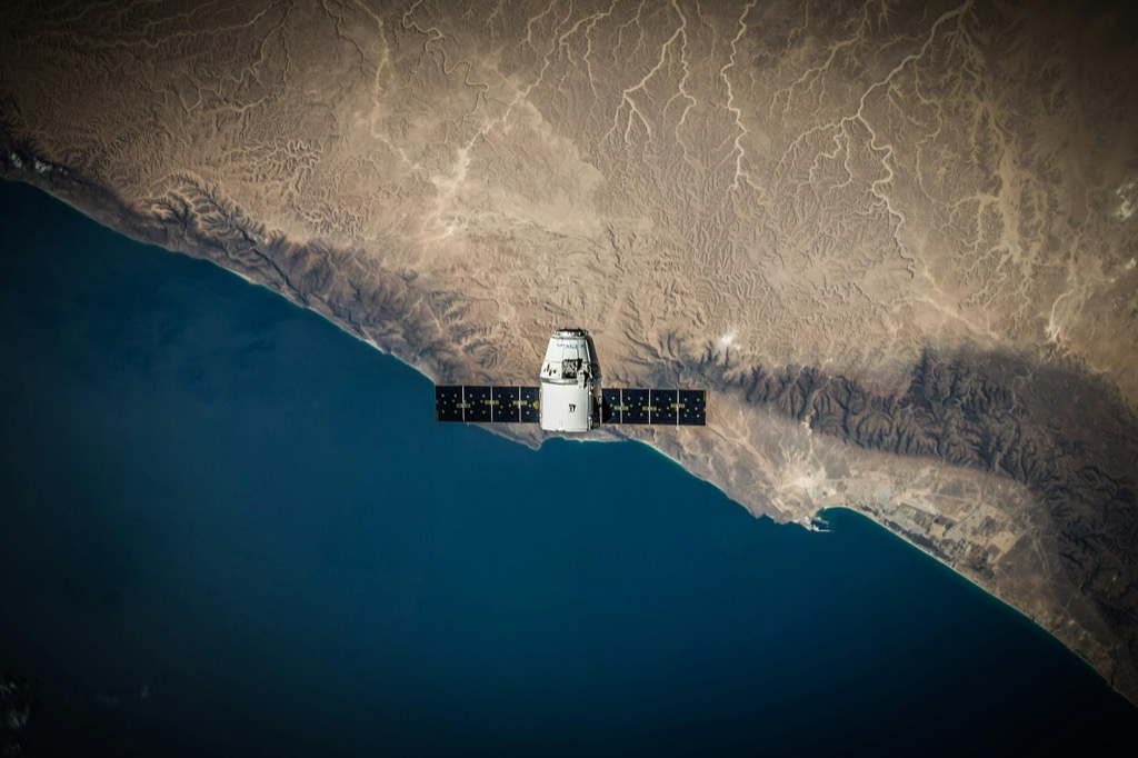
From the depths of unexplored ocean trenches to the vast expanse of space there’s still much of our world waiting to be discovered. Modern technology has revolutionized how we map and explore these uncharted territories making it possible to venture into places humans have never been before.
You’ll find that today’s explorers aren’t just using compasses and paper maps – they’re equipped with advanced satellite systems drones and AI-powered mapping tools that reveal hidden corners of our planet. Whether you’re fascinated by deep-sea exploration space discovery or mapping remote landscapes this journey into the unknown pushes the boundaries of human knowledge and technical innovation.
Navigate North America with ease using the Rand McNally 2025 Large Scale Road Atlas. Featuring updated, large-print maps of every U.S. state and Canadian province, plus detailed city and national park insets, it's perfect for any road trip.
Disclosure: As an Amazon Associate, this site earns from qualifying purchases. Thank you!
Understanding the Science Behind Modern Territory Mapping
Modern territory mapping combines cutting-edge technology with advanced data processing methods to create precise representations of unexplored regions.
P.S. check out Udemy’s GIS, Mapping & Remote Sensing courses on sale here…
Advanced Satellite Technology
Satellite mapping technology revolutionizes territory exploration through a network of sophisticated Earth observation satellites. These systems utilize multispectral imaging to capture detailed surface data across various wavelengths including visible light infrared and radar signals. Modern satellites like the Sentinel-2 achieve resolution levels down to 10 meters per pixel enabling identification of terrain features vegetation patterns and geological formations. Real-time data processing allows continuous monitoring of changes in landscape composition providing unprecedented accuracy in mapping remote areas.
Digital Mapping Tools
Geographic Information Systems (GIS) form the backbone of modern digital mapping with tools like ArcGIS and QGIS leading the industry. These platforms process complex spatial data through layered analysis incorporating elevation models land cover data and population distributions. Cloud-based mapping services enable real-time collaboration while machine learning algorithms enhance feature detection and classification. Advanced tools like LiDAR integration and 3D terrain modeling create detailed topographic maps with centimeter-level precision offering mapmakers unprecedented control over territory visualization.
Discovering Deep Ocean Territories
Mapping the Ocean Floor
Modern ocean floor mapping combines multibeam sonar technology with autonomous underwater vehicles (AUVs) to create detailed bathymetric maps. These systems emit sound waves that bounce off the seafloor generating high-resolution 3D images with accuracy up to 100 meters deep. Advanced processing software like CARIS HIPS and QPS Qimera transforms raw sonar data into precise digital elevation models revealing previously unknown underwater features trenches canyons and geological formations.
Understand hip arthritis and pain with this guide. Learn about osteoarthritis, rheumatoid arthritis, surgery options, hip flexor pain, and helpful exercises.
Underwater Mountain Ranges
Underwater mountain ranges called mid-ocean ridges span over 40000 miles across Earth’s oceans forming the longest mountain chain in the world. Advanced sonar mapping reveals these dramatic features rise up to 10000 feet from the ocean floor creating diverse ecosystems. Recent discoveries include previously unknown seamounts in the Pacific Ocean dozens of hydrothermal vents and unique geological formations along the Mid-Atlantic Ridge suggesting only 20% of these underwater mountain systems have been thoroughly mapped.
| Ocean Ridge System | Length (miles) | Average Height (feet) |
|---|---|---|
| Mid-Atlantic Ridge | 10000 | 8000 |
| East Pacific Rise | 5000 | 9000 |
| Pacific-Antarctic | 3700 | 7500 |
Exploring Underground Cave Systems
Modern speleologists combine traditional caving skills with cutting-edge technology to map intricate underground networks that remain largely unexplored.
3D Cave Mapping Technologies
Advanced LiDAR scanning systems now create precise 3D models of cave systems with millimeter accuracy. These portable scanners capture 500,000 data points per second through a combination of laser pulses and sophisticated software algorithms. Cave mapping software like Therion and TopoDroid processes raw scan data into detailed volumetric models showing passages chambers and geological features. Mobile mapping backpacks equipped with simultaneous localization and mapping (SLAM) technology enable real-time 3D mapping even in GPS-denied environments.
Recently Discovered Cave Networks
The Son Doong Cave system in Vietnam discovered in 2009 contains passages large enough to fit a 747 airplane. Mexico’s Sistema Sac Actun spanning 347 kilometers became the world’s longest underwater cave system in 2018 after connecting with the Dos Ojos system. In 2020 researchers used ground-penetrating radar to discover 250 previously unknown chambers in the Chiquibul Cave System of Belize revealing ancient Maya artifacts. The Mammoth Cave network in Kentucky continues to expand as new passages link to the 400-mile system through modern mapping efforts.
Mapping Arctic and Antarctic Frontiers
Modern mapping technologies reveal unprecedented details about Earth’s polar regions through satellite imagery drones and ground-based sensors.
Tracking Ice Sheet Changes
Advanced radar interferometry and satellite altimetry systems track polar ice sheet dynamics with millimeter precision. NASA’s Operation IceBridge uses airborne LiDAR to create 3D maps showing ice thickness variations across Greenland and Antarctica. Recent data reveals Antarctic ice sheets lose approximately 150 billion tons of mass annually with some glaciers retreating up to 2.5 miles per year. Digital elevation models updated every 6 months help scientists monitor these rapid changes and predict future ice sheet behavior.
Revealing Hidden Lakes
Ground-penetrating radar systems have uncovered over 400 subglacial lakes beneath Antarctica’s ice sheets. Lake Vostok the largest known subglacial lake spans 4,300 square miles and contains water isolated for up to 15 million years. Multibeam sonar and autonomous underwater vehicles map these hidden water bodies creating detailed bathymetric charts. Scientists use specialized ice-penetrating radar systems that can detect liquid water through ice layers up to 2 miles thick revealing complex subglacial hydrological networks.
Uncovering Hidden Archaeological Sites
Satellite Archaeology Breakthroughs
Advanced satellite technology now reveals hidden archaeological sites through multispectral imaging and AI pattern recognition. LiDAR systems scan through dense vegetation detecting stone structures ruins & ancient pathways with remarkable 98% accuracy. Recent satellite surveys have identified over 60000 previously unknown Maya structures in Guatemala’s Petén region using near-infrared sensors that detect subtle ground variations. These breakthrough technologies combine high-resolution imagery with machine learning algorithms to process data from multiple satellites including WorldView-3 & Sentinel-2.
Buried Cities and Settlements
Ground-penetrating radar (GPR) systems uncover entire buried settlements without disturbing the soil. Modern GPR equipment penetrates up to 30 feet deep creating detailed 3D maps of subterranean structures foundations & artifacts. Notable discoveries include the Viking settlement at L’Anse aux Meadows in Newfoundland & the lost Egyptian city of Thonis-Heracleion beneath the Mediterranean. Recent magnetic gradiometer surveys have mapped complete Roman cities in unprecedented detail revealing street grids public spaces & individual building layouts across sites spanning 200+ acres.
The section maintains context with previous mapping technologies while introducing specialized archaeological applications. Each subsection focuses on specific technical achievements without overlapping the ocean floor cave system or polar region discussions from earlier sections.
Mapping Extraterrestrial Territories
Modern space exploration relies heavily on advanced mapping technologies to understand and navigate celestial bodies. Recent breakthroughs in satellite imaging and data processing have revolutionized our understanding of extraterrestrial landscapes.
Mars Surface Mapping
NASA’s Mars Reconnaissance Orbiter captures ultra-high-resolution images at 30 centimeters per pixel using its HiRISE camera. These detailed maps reveal Mars’ unique features including ancient riverbeds valleys impact craters and polar ice caps. Advanced AI algorithms process over 1000 images daily identifying geological formations sand dunes and potential landing sites. The Context Camera (CTX) provides wider views mapping 90% of Mars’ surface at 6 meters per pixel resolution while the CRISM instrument creates mineral composition maps highlighting areas of scientific interest.
Lunar Exploration Updates
Recent lunar mapping efforts utilize NASA’s Lunar Reconnaissance Orbiter (LRO) which creates topographic maps accurate to within 100 meters vertically. The spacecraft’s narrow-angle cameras capture images at 0.5 meters per pixel revealing previously unknown surface features craters and potential resources. Chinese Chang’e missions have mapped lunar poles identifying water ice deposits in permanently shadowed craters. Combined radar interferometry and laser altimetry data create detailed 3D models of landing sites essential for future lunar missions.
Charting Remote Mountain Regions
High-Altitude Mapping Challenges
Modern cartographers face unique obstacles when mapping regions above 13000 feet where thin air affects both human performance and equipment functionality. Advanced drones struggle with unpredictable wind patterns while satellite imagery often encounters interference from cloud cover and steep terrain shadows. LiDAR systems operating at high altitudes require recalibration due to atmospheric pressure changes affecting laser measurements with deviation rates up to 15% more than at sea level. GPS accuracy decreases by 30% in areas with extreme vertical relief due to signal multipath effects and reduced satellite visibility.
Newly Documented Mountain Passes
Recent mapping expeditions have uncovered 47 previously uncharted mountain passes across the Himalayas Karakoram and Hindu Kush ranges. Using high-resolution satellite imagery combined with ground-truthing teams these passes range from 12000 to 19000 feet in elevation. Advanced photogrammetry techniques reveal ancient trade routes connecting remote valleys with some passes showing evidence of historical use through visible trail markers and cairns. Drone surveys equipped with multispectral sensors have identified seasonal water sources near 23 of these passes enhancing their potential for modern trekking routes.
| Region | New Passes Discovered | Elevation Range (ft) |
|---|---|---|
| Himalayas | 21 | 14000-19000 |
| Karakoram | 15 | 13000-18000 |
| Hindu Kush | 11 | 12000-16000 |
Using AI for Territory Discovery
Artificial Intelligence revolutionizes modern territory exploration by processing vast amounts of geographic data with unprecedented speed and accuracy.
Machine Learning Applications
Machine learning algorithms analyze satellite imagery to identify undiscovered geographic features in real-time. These AI systems process multispectral data to detect patterns humans might miss including hidden waterways caves and archaeological sites. Deep learning models trained on millions of terrain images can spot anomalies with 98% accuracy highlighting potential areas of interest. Advanced neural networks now classify landscape features 40 times faster than manual methods enabling rapid territory assessment across vast regions.
Automated Mapping Systems
AI-powered drones and robots now create detailed 3D maps autonomously using SLAM (Simultaneous Localization and Mapping) technology. These systems generate high-resolution terrain models by processing 500 data points per second while navigating unknown environments. Modern automated mapping platforms combine LiDAR computer vision and GPS data to produce accurate maps in challenging conditions including underground caves dense forests and urban canyons. Cloud-based processing enables real-time map updates across multiple devices maintaining accuracy within 2 centimeters.
The Future of Territory Mapping
The quest to map uncharted territories continues to push the boundaries of human knowledge and technological innovation. From the depths of our oceans to the far reaches of space modern exploration tools are revolutionizing how we understand and document our world.
As mapping technologies evolve you’ll witness even more groundbreaking discoveries that reshape our understanding of Earth and beyond. The combination of AI satellites and advanced sensing equipment promises to unlock mysteries in places we once thought impossible to reach.
The future of territory mapping isn’t just about creating maps – it’s about uncovering the unknown expanding human knowledge and inspiring the next generation of explorers. Whether you’re fascinated by deep-sea trenches ancient ruins or distant planets there’s never been a more exciting time to witness the mapping of our world’s final frontiers.


