11 Typography Secrets That Transform Modern Maps
Typography transforms ordinary maps into powerful tools of communication where every font choice shapes how you understand geographic information. When you’re looking at a map the text elements do much more than simply label locations – they establish hierarchy guide your eye and create visual harmony that makes complex spatial data instantly digestible. Whether you’re a cartographer designer or just someone who appreciates good maps understanding typography’s role helps you better interpret and create maps that effectively tell geographic stories.
From ancient hand-drawn maps to modern digital cartography typography remains one of the most crucial yet often overlooked elements that determines a map’s success in conveying information. The careful selection of typefaces spacing and text placement can mean the difference between a confusing jumble of letters and a clear compelling visualization that helps users navigate both physical and conceptual landscapes.
Disclosure: As an Amazon Associate, this site earns from qualifying purchases. Thank you!
Understanding the Foundations of Map Typography
Typography forms the backbone of effective map communication, serving as a bridge between geographic data and human comprehension.
Historical Evolution of Map Lettering
Map lettering has transformed dramatically from ancient hand-drawn manuscripts to modern digital displays. Early cartographers used calligraphy to label features with distinct regional styles like Roman capitals Islamic Kufic script. The 1900s brought standardized typefaces with the advent of mechanical typesetting while the digital revolution introduced scalable fonts specialized for cartographic use. Notable innovations include Eduard Imhof’s Swiss style typography guidelines in 1962 which revolutionized mountain map labeling.
Basic Principles of Cartographic Typography
Effective map typography relies on five core principles: hierarchy legibility contrast spacing and consistency. Font sizes establish visual importance with larger text for primary features and smaller for details. Sans-serif typefaces like Helvetica enhance readability at small sizes while serif fonts add authority to titles. Letter spacing (tracking) must adapt to feature curves with 25-30% more space on curved paths than straight lines. Colors should maintain 60% contrast with the background while font weights guide viewers through different information layers.
Selecting the Right Typefaces for Map Design
Choosing appropriate typefaces is crucial for creating clear readable maps that effectively communicate geographic information.
Serif vs. Sans Serif in Cartography
Sans serif fonts like Helvetica and Arial excel in digital maps due to their clean lines and screen readability. Serif typefaces including Times New Roman and Georgia work best for printed maps showing natural features terrain or historical contexts. For optimal results use sans serif fonts for urban features roads and labels under 8pt while reserving serifs for water bodies mountain ranges and descriptive text above 10pt.
Escape the ordinary and embrace adventure! *Times New Roman* chronicles one couple's journey of quitting their jobs, decluttering their lives, and moving to Italy. Discover inspiration for your own life change through their experiences.
Font Hierarchy in Geographic Information
Establish a clear visual hierarchy through strategic font sizing and weight variations. Use larger bold fonts (14-16pt) for primary features like major cities and water bodies. Apply medium sizes (10-12pt) for secondary elements such as regional boundaries and minor cities. Reserve smaller sizes (8-9pt) for tertiary information including street names and point-of-interest labels. Maintain consistent size relationships across similar feature types to reinforce the information hierarchy.
Mastering Typography Placement in Maps
Strategic placement of typography transforms a basic map into an intuitive navigation tool. Let’s explore proven techniques for optimal text placement and density management.
Label Positioning Best Practices
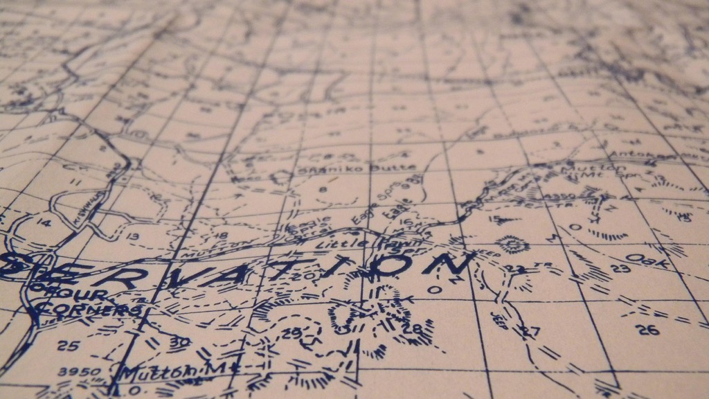
Position city labels to the right of point symbols except when geographic features interfere. Place water body names in a gentle curve following the feature’s shape with horizontal letter spacing. Angle road labels along their paths at 0-60 degrees keeping text upright. Mount river names parallel to flow lines with consistent spacing between letters. Reserve uppercase for major features like COUNTRIES or OCEANS while using title case for cities and landmarks.
Managing Text Density and Overlap
Control label density by prioritizing features based on importance hierarchy. Remove redundant labels where features are easily identifiable. Implement automatic label collision detection in digital maps using tools like Mapbox or QGIS. Adjust font sizes proportionally when zooming to maintain readable text density. Use halos or masks around text in dense areas to improve contrast against background features while preserving underlying geographic information.
Enhancing Map Readability Through Typography
Clear typography transforms complex geographic information into easily digestible visual content for map users.
Size and Scale Considerations
The right font size directly impacts map usability across different scales. Use 8-10pt type for detailed features like street names 12-14pt for neighborhood labels and 16-18pt for major cities or regions. Implement dynamic scaling in digital maps where text grows proportionally with zoom levels. Set minimum legible sizes of 6pt for printed maps and 10px for digital displays to maintain readability while preserving detail density.
Color and Contrast in Map Labels
Choose text colors that achieve a minimum contrast ratio of 4.5:1 against the background for optimal readability. Apply dark text on light terrains and white text with thin halos on darker areas. Use consistent color schemes where water features appear in blue text hydrographic labels city names in black and elevation markers in brown. Avoid red-green combinations to ensure colorblind accessibility while maintaining a clear visual hierarchy through strategic color selection.
Experience comfortable viewing with reduced blue light emissions and accurate colors thanks to Dell's ComfortView Plus. Enjoy smooth visuals with a 100Hz refresh rate and versatile connectivity with dual HDMI ports.
Implementing Typography for Different Map Types
Digital Interactive Maps
Digital interactive maps require dynamic typography that adapts to various zoom levels and screen sizes. Set your base font sizes to scale proportionally with zoom levels using responsive design principles. Implement clear font hierarchies with sans-serif typefaces like Open Sans or Roboto for optimal screen readability. Use JavaScript libraries such as Mapbox GL JS or Leaflet to manage automatic label placement and configure collision detection settings. Consider implementing hover states and interactive labels that reveal additional information while maintaining a clean interface at default view.
Experience ultimate comfort and clarity with Open Sans. This versatile font ensures readability across all platforms and devices with its clean, humanist design, making it perfect for any project.
Print-Based Cartographic Design
Print maps demand careful attention to resolution and physical scale considerations for typography. Choose serif fonts like Minion Pro or Palatino for detailed terrain features and establish a minimum font size of 6pt for legibility in print. Apply manual label placement techniques to achieve optimal positioning without relying on automatic placement algorithms. Consider using overprinting effects for labels that cross linear features and implement tight kerning controls to maximize space efficiency. Test print proofs at actual size to verify text clarity and readability across different printing conditions.
Get a comfortable and secure grip with the Wilson Minions Pro Overgrip 3-pack. Featuring a thin, elastic felt material and fun Minion designs, this durable overgrip includes finishing tape for easy application.
Addressing Multilingual Typography Challenges
Creating maps that effectively communicate across different languages and writing systems requires careful consideration of typography and cultural sensitivity.
Managing Multiple Scripts and Languages
Unicode support forms the foundation of multilingual map typography by enabling the display of various writing systems like Latin Arabic Chinese and Cyrillic scripts. Design flexible typography systems using font families that support multiple scripts such as Noto or Source Sans Pro. Implement right-to-left text handling for Arabic and Hebrew while maintaining consistent label placement rules. Use specialized cartographic fonts like PT Sans that include extensive character sets for geographical names and diacritical marks.
Cultural Considerations in Map Text
Respect local naming conventions and transliteration standards when displaying place names across different languages. Consider the cultural significance of typography choices such as using traditional scripts for historical sites or religious locations. Apply appropriate font hierarchies that work across writing systems while maintaining readability in each language. Verify translations with native speakers to ensure accuracy and cultural appropriateness of map labels.
Optimizing Typography for Map Scale Changes
Managing typography across different map scales requires careful consideration of readability and information hierarchy while maintaining visual consistency.
Dynamic Type Sizing
Dynamic type sizing automatically adjusts font sizes based on zoom levels to maintain optimal readability. Implement size ratios where text grows proportionally as users zoom in starting with a 1:2 scale ratio for major to minor features. Set minimum font sizes of 8px for digital displays and maximum sizes of 24px for primary labels to prevent oversized text from dominating the view. Use JavaScript libraries like Mapbox GL JS or Leaflet to handle smooth size transitions between zoom levels.
Responsive Typography Solutions
Deploy responsive typography systems that adapt to both scale changes and viewport sizes. Use CSS relative units like em or rem to create flexible type scaling rather than fixed pixel values. Implement media queries to adjust label density at different breakpoints with automated label prioritization keeping only essential text visible at smaller scales. Consider using variable fonts that can adjust weight and width dynamically providing better control over text appearance across scales.
Balancing Aesthetics and Functionality
Creating effective map typography requires a delicate equilibrium between visual appeal and practical usability.
Typography’s Role in Map Branding
Typography serves as a powerful branding tool in map design by establishing a unique visual identity. Custom typefaces can reflect an organization’s character while maintaining cartographic clarity. Leading mapping platforms like Google Maps use their signature font Roboto to create brand recognition while National Geographic maps employ distinctive serif typefaces that evoke exploration and authority. Your font choices should align with your brand guidelines yet preserve essential map functionality through careful weight selection spacing and scaling.
Maintaining Visual Harmony
Balance visual elements through consistent typography that complements other map features. Use no more than 2-3 typeface families with clear hierarchical relationships between primary secondary and tertiary labels. When selecting fonts consider how they interact with terrain symbols roads and water features. For example pair rounded sans-serif fonts with curved coastlines or angular typefaces with urban grid patterns. Maintain proportional sizing where major city labels are 25-30% larger than surrounding town names creating natural visual flow.
Adapting Typography for Modern Mapping Platforms
Modern mapping platforms require flexible typographic solutions that adapt to diverse user needs and technological constraints while maintaining clarity and functionality.
Mobile Device Considerations
Mobile maps demand specialized typography optimization for small screens and touch interfaces. Use larger font sizes (minimum 12px) and increased letter spacing to improve readability on smartphones and tablets. Select condensed typefaces like Roboto Condensed or SF Compact that maximize space efficiency. Implement touch-friendly label spacing of at least 44px between clickable elements. Use font-weight adjustments (500-700) to maintain visibility in varying lighting conditions rather than relying on size alone.
Miele HEPA AirClean filters trap 99.95% of dust and allergens, ensuring cleaner air. The TimeStrip indicator signals when it's time to replace the filter, maintaining optimal vacuum performance.
Web-Based Mapping Requirements
Web maps require responsive typography that performs consistently across browsers and devices. Implement vector-based fonts like Google’s Noto family or MapboxGL’s built-in typefaces for crisp scaling. Set relative font sizes using viewport units (vw) to maintain proportions during zoom operations. Enable font subsetting to reduce load times while supporting multiple languages. Use CSS containment properties to optimize rendering performance and WebGL for smooth label animations during pan and zoom interactions.
Embracing Future Trends in Map Typography
Typography remains at the heart of effective map design evolving alongside technological advancements. The principles and practices you’ve discovered here will help you create maps that communicate clearly and engage your audience effectively.
As digital cartography continues to advance you’ll find new opportunities to enhance your typographic choices through AI-assisted label placement dynamic scaling and improved multilingual support. Whether you’re designing for print or digital platforms the fundamental goal stays constant: creating maps that tell compelling geographic stories through thoughtful typography.
Remember that successful map typography balances aesthetics with functionality while maintaining clarity across different scales and devices. By applying these principles you’ll create maps that not only look professional but also serve their essential purpose of clear geographic communication.


