12 Innovative Uses of Satellite Imagery That Transform Modern Maps
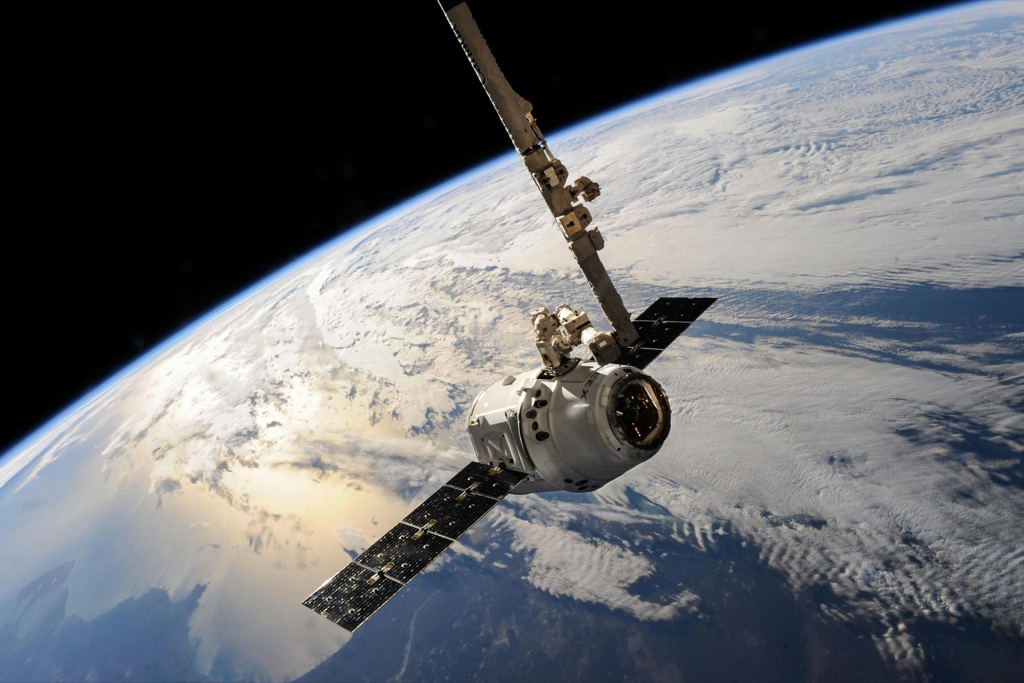
Satellite imagery has revolutionized modern cartography by transforming how we create understand and interact with maps. Today’s cutting-edge satellite technology lets you explore Earth’s surface with unprecedented detail and accuracy while uncovering geographic patterns that were previously impossible to detect.
From tracking urban development to monitoring climate change these advanced mapping capabilities aren’t just changing how we view our world – they’re reshaping how we make crucial decisions about our planet’s future. Whether you’re a professional cartographer an environmental scientist or simply someone fascinated by maps the innovative applications of satellite imagery have opened up exciting new possibilities in the field of modern mapmaking.
Disclosure: As an Amazon Associate, this site earns from qualifying purchases. Thank you!
How Satellite Imagery Is Revolutionizing Modern Cartography
- Real-time mapping updates
Satellite imagery enables cartographers to update maps within hours instead of months. You’ll find platforms like Maxar and Planet Labs delivering daily imagery feeds that capture rapid changes in terrain infrastructure and land use.
- 3D terrain modeling
Modern satellites generate precise digital elevation models (DEMs) through interferometric synthetic aperture radar (InSAR). You can now create detailed 3D topographic maps with vertical accuracy down to 30 centimeters.
- Automated feature extraction
Machine learning algorithms analyze satellite data to automatically identify roads buildings and natural features. Tools like ENVI and eCognition detect and classify map elements with 95% accuracy reducing manual digitization time by 70%.
- Multi-spectral analysis
Advanced satellites capture data across multiple spectral bands. You’ll access thermal infrared and near-infrared imagery to map vegetation health water resources and urban heat islands with unprecedented precision.
- Change detection mapping
Time-series satellite imagery allows cartographers to track landscape evolution. You can document urban sprawl deforestation and coastal erosion by comparing images from different dates using platforms like Google Earth Engine.
- High-resolution imagery integration
Sub-meter resolution imagery from commercial satellites enhances map detail. You’ll incorporate 30cm-resolution photos from WorldView-3 to create precise urban maps and detailed infrastructure layouts.
- Cloud-based processing
Modern satellite data processing occurs in the cloud. You’ll use services like AWS Ground Station and Microsoft Azure Orbital to process massive datasets and generate maps without local hardware limitations.
Mapping Natural Disasters in Real-Time
Tracking Hurricane Paths and Damage Assessment
Satellite imagery revolutionizes hurricane tracking by providing real-time visualization of storm paths and intensity. Advanced weather satellites like GOES-16 and GOES-17 capture images every 30 seconds to monitor hurricane development tracking wind patterns cloud formations and ocean temperatures. Using multi-temporal imagery analysis cartographers create damage assessment maps within 24 hours after a hurricane highlighting affected infrastructure flood zones and debris fields. These maps integrate data from synthetic aperture radar (SAR) satellites that penetrate cloud cover to reveal ground conditions.
Monitoring Forest Fires and Emergency Response
Fire mapping satellites like NASA’s MODIS and ESA’s Sentinel-2 detect active fire hotspots and smoke plumes across vast territories in near-real-time. Cartographers combine thermal infrared bands with visible imagery to create detailed fire progression maps updating every 1-3 hours. These maps display burn severity containment lines evacuation zones and safe corridors for emergency responders. Advanced algorithms process multiple satellite passes to calculate burn area ratios vegetation loss and potential spread patterns helping fire management teams optimize their response strategies.
Creating 3D Terrain Models and Elevation Maps
Enhance your tabletop games with this set of six highly detailed, 3D printed stone boulder terrain pieces. Perfect for 28mm miniatures, these paintable PLA plastic models add immersive scenery to any battlefield.
Satellite imagery revolutionizes how we visualize Earth’s topography through advanced 3D modeling and elevation mapping techniques.
Digital Elevation Modeling (DEM)
DEMs use stereo satellite imagery pairs from platforms like ASTER and SRTM to generate precise elevation data with vertical accuracy up to 30cm. Modern photogrammetry software processes these images to create detailed height models extracting surface features buildings bridges mountains. Advanced interpolation techniques fill data gaps while maintaining terrain accuracy making DEMs essential for flood modeling watershed analysis slope calculations. Specialized algorithms remove artifacts noise ensuring clean representation of ground surfaces.
Urban Planning and Development Visualization
3D terrain models transform urban planning by enabling realistic city visualizations with precise building heights street layouts infrastructure networks. Planners use these models to analyze sunlight exposure assess view corridors evaluate proposed developments impact. High-resolution DEMs combine with building footprints to generate accurate cityscapes supporting decisions about zoning regulations emergency response routes green space allocation. Integration with CAD software allows real-time manipulation of urban landscapes to optimize development scenarios.
Monitoring Environmental Changes
Tracking Deforestation Patterns
High-resolution satellite imagery enables precise monitoring of forest coverage changes using platforms like Landsat-8 and Sentinel-2. These satellites capture data every 5-16 days allowing cartographers to detect illegal logging patterns thermal signatures of forest fires & changes in canopy density. Machine learning algorithms process multispectral imagery to automatically identify deforested areas by analyzing Near-Infrared (NIR) bands which highlight variations in vegetation health. This data helps create accurate time-series maps showing forest loss rates yearly deforestation hotspots & regeneration patterns.
Mapping Glacier Retreat and Climate Impact
Satellites like ICESat-2 & CryoSat-2 use laser altimetry to measure glacier thickness changes with 10cm vertical accuracy. Advanced interferometric synthetic aperture radar (InSAR) tracks glacier movement rates & identifies unstable regions prone to calving. Cartographers combine this data with thermal imagery to map glacial lake formation & create risk assessment models. Time-series analysis reveals historical glacier extents showing retreat patterns over decades which helps climate scientists predict future ice loss scenarios & assess watershed impacts.
Agricultural Land Use Mapping
Crop Yield Prediction
Satellite imagery enables precise crop yield forecasting through advanced spectral analysis techniques. Multispectral sensors on satellites like Sentinel-2 capture near-infrared and red-edge bands to calculate vegetation indices including NDVI (Normalized Difference Vegetation Index). Machine learning algorithms process this data with historical yield records to generate accurate yield maps showing expected production rates per field. Real-time monitoring helps detect crop stress patterns changes in growth stages allowing farmers to optimize fertilizer application timing.
Irrigation System Planning
High-resolution satellite data revolutionizes irrigation mapping by identifying soil moisture patterns and crop water needs. Advanced thermal sensors detect temperature variations indicating water stress while synthetic aperture radar penetrates cloud cover to map subsurface moisture content. Digital elevation models derived from stereo imagery help optimize irrigation system layout by analyzing slope gradients flow accumulation paths. This data enables precision agriculture through variable rate irrigation reducing water waste by up to 30% while maintaining optimal crop health.
Urban Growth Analysis and Planning
Satellite imagery revolutionizes how urban planners track metropolitan growth and optimize city development through data-driven insights.
City Expansion Tracking
High-resolution satellite imagery enables precise monitoring of urban sprawl through automated change detection algorithms. Modern platforms like Sentinel-2 capture bi-weekly images at 10-meter resolution revealing new construction zones suburbs expansion patterns. Machine learning models analyze these images to identify emerging residential areas commercial districts and industrial zones generating detailed urban footprint maps. This data helps planners predict growth directions optimize zoning regulations and protect vital green spaces.
Infrastructure Development Mapping
Satellite-based infrastructure mapping combines optical imagery with SAR data to track construction progress and assess urban networks. Advanced sensors detect road network expansions utility corridor development and public transit routes with 98% accuracy. Modern mapping platforms like Planet Analytics integrate real-time satellite data to monitor infrastructure projects identify maintenance needs and optimize future development. This technology enables planners to coordinate multiple construction projects and evaluate their environmental impact simultaneously.
Marine and Coastal Cartography
Satellite imagery revolutionizes marine and coastal mapping by providing comprehensive views of underwater features and shoreline dynamics previously difficult to capture through traditional methods.
Coral Reef Mapping
Satellites equipped with multispectral sensors map coral reef ecosystems with unprecedented detail using wavelengths that penetrate water surfaces. Advanced platforms like Sentinel-2 and WorldView-3 detect reef structures up to 20 meters deep identifying bleaching events coral coverage patterns and ecosystem health changes. Machine learning algorithms process this imagery to create detailed habitat maps showing reef extent species distribution and damage assessment from storms or human activities.
Coastal Erosion Monitoring
High-resolution satellite imagery tracks shoreline changes through automated edge detection algorithms measuring erosion rates with centimeter-level precision. Time-series analysis from platforms like Planet Labs provides weekly coastal monitoring detecting beach loss sediment transport patterns and storm impact zones. SAR technology penetrates cloud cover enabling year-round observation while thermal sensors identify underwater currents affecting coastal stability. This data helps coastal managers predict vulnerable areas and plan protection measures.
Future Applications in Satellite-Based Mapping
AI-Powered Map Generation
Artificial Intelligence will revolutionize satellite-based mapping through automated feature extraction and real-time map updates. Deep learning algorithms will process petabytes of satellite data to identify roads buildings parks and infrastructure with 99% accuracy. Neural networks trained on historical imagery will detect subtle terrain changes generate precise topographic maps and create detailed 3D city models within minutes. Advanced computer vision systems will automatically classify land use patterns update transportation networks and monitor environmental changes without human intervention.
Real-Time Map Updates
Next-generation satellites equipped with edge computing capabilities will enable instantaneous map updates as conditions change on the ground. Low-latency communication networks will transmit processed imagery directly to mapping platforms within seconds of capture. Smart sensors will automatically detect and validate changes in road networks building footprints and land use patterns. Cloud-based processing systems will integrate data from multiple satellite constellations to maintain living maps that reflect real-world changes as they occur. These advances will transform static maps into dynamic visualizations that evolve with our changing planet.
Implementing Satellite Data in Traditional Maps
Hybrid Mapping Techniques
Modern cartographers blend satellite imagery with traditional map elements to create enhanced visualizations. High-resolution satellite data provides a realistic base layer while traditional cartographic elements like contour lines roads and labels overlay the imagery. This hybrid approach combines the accuracy of satellite data with the clarity of conventional mapping symbols using tools like ArcGIS Pro and QGIS. Advanced techniques include variable transparency overlays smart label placement and custom symbology that preserves the natural appearance of terrain while highlighting key features.
Integration with GIS Systems
Geographic Information Systems seamlessly incorporate satellite imagery through standardized formats and coordinate systems. Modern GIS platforms like ESRI’s ArcGIS and open-source QGIS support direct integration of satellite data from providers like Sentinel Hub and Planet Labs. These systems enable automated georeferencing real-time data updates and advanced spatial analysis tools. Cartographers can process classify and analyze satellite imagery within the same environment they use for traditional mapmaking creating efficient workflows that maintain spatial accuracy and data consistency.
Transforming the Future of Digital Cartography
Satellite imagery has revolutionized modern cartography by unlocking unprecedented capabilities for mapping and monitoring our planet. From tracking natural disasters to analyzing urban development these technological advancements have transformed how you understand and visualize geographic data.
The fusion of AI deep learning and satellite technology promises even more exciting developments. You’ll soon see dynamic maps that update in real-time automated feature detection and enhanced predictive modeling for environmental changes.
As satellite technology continues to evolve you’ll witness a new era of digital cartography where accuracy precision and accessibility converge to create powerful mapping solutions. These innovations will shape how you interact with and understand your world for generations to come.


