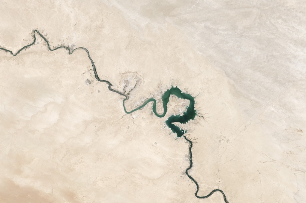
10 Ways Topography Shapes Land Use: Revealing Nature’s Hidden Patterns
The intricate relationship between topography and land use shapes our environment in profound ways. From steep mountain slopes that limit urban development to gentle valleys that cradle agricultural activities topographic features significantly influence how we utilize the Earth’s surface. Understanding this crucial connection helps planners developers and policymakers make informed decisions about sustainable land management while maximizing the potential of different terrains.
As you explore various landscapes you’ll notice how elevation slope and terrain characteristics dictate everything from farming practices to urban planning. These natural features create both opportunities and constraints affecting where we build cities establish agricultural zones and preserve natural areas. The relationship between land forms and human activities continues to evolve as new technologies and innovative approaches help us adapt to and work with nature’s contours.
Disclosure: As an Amazon Associate, this site earns from qualifying purchases. Thank you!
Understanding Topography and Its Key Elements
Topography encompasses the physical features of Earth’s surface that shape how we use and interact with the land.
Landforms and Natural Features
Landforms define the basic structure of any landscape through distinct physical characteristics. Mountains provide natural barriers while creating opportunities for tourism & renewable energy. Valleys offer fertile soil for agriculture & sheltered areas for settlement. Coastal areas support maritime activities transportation hubs & recreation. Plains facilitate large-scale farming urban development & transportation networks. Rivers shape settlement patterns by providing water resources & natural transportation routes.
Elevation and Slope Characteristics
Elevation differences create distinct microclimates that influence vegetation patterns & land use possibilities. Steep slopes above 20% typically restrict development & require specialized engineering solutions. Gentle slopes between 2-8% are ideal for agriculture & urban development. Flat areas below 2% may face drainage issues but excel for industrial & commercial use. High-elevation zones often support specialized agriculture forestry or conservation efforts while affecting infrastructure costs & accessibility.
Geological Formations
Geological structures determine soil quality mineral resources & construction feasibility. Bedrock composition influences foundation stability & building costs. Sedimentary formations often indicate potential fossil fuel deposits & groundwater availability. Volcanic areas provide rich soils for agriculture but pose natural hazards. Fault lines require special construction considerations & impact development patterns. Rock types affect erosion patterns drainage systems & mineral extraction possibilities.
Examining How Topography Influences Human Settlement
Topographic features play a crucial role in determining where and how human populations establish communities.
Historical Settlement Patterns
Early civilizations consistently chose locations near water bodies and in valleys due to natural advantages. River valleys like the Nile Indus and Yangtze supported major ancient settlements by providing fertile soil abundant water and natural transportation routes. Coastal areas attracted settlements for fishing and trade while elevated areas offered defensive advantages. Many historical cities such as Rome Athens and Constantinople developed on hills that provided both protection and strategic viewpoints for monitoring surroundings.
Urban Development in Different Terrains
Cities adapt their growth patterns based on the underlying topography of their location. Flat terrains enable grid-like street patterns and expansive development as seen in cities like Chicago and Phoenix. Hilly regions force cities to develop in clusters with terraced architecture like San Francisco and Hong Kong. Coastal cities often spread linearly along shorelines while mountain towns typically grow in valleys following natural contours. Development costs and engineering requirements vary significantly based on terrain challenges.
Accessibility and Transportation Networks
Topography directly shapes transportation infrastructure and accessibility patterns. Mountain passes determine highway routes while river valleys guide railway lines through challenging terrain. Cities in flat regions typically have well-connected grid networks while those in hilly areas often rely on tunnels bridges and winding roads. Natural barriers like mountains and water bodies create transportation bottlenecks that influence urban growth patterns. Modern engineering helps overcome topographic constraints but construction and maintenance costs increase significantly in challenging terrain.
Analyzing the Impact of Topography on Agricultural Practices
Topography plays a crucial role in shaping agricultural productivity and determining suitable farming practices across different landscapes.
Soil Formation and Quality
Topographical features directly influence soil development through erosion weathering and mineral deposition processes. Steep slopes often have thin topsoil layers with limited organic matter while valley bottoms accumulate rich fertile sediments. Elevation changes create distinct soil profiles with varying pH levels mineral content and drainage characteristics that determine crop suitability. Mountain slopes typically produce well-drained soils ideal for certain crops like coffee tea and grapes while lowland areas develop deeper more nutrient-rich soils perfect for grain production.
Irrigation and Water Management
Landscape elevation dictates natural water flow patterns affecting irrigation system design and efficiency. Gravity-fed irrigation works well on gentle slopes while steep terrain requires specialized systems like drip irrigation or terracing. Valley locations benefit from natural groundwater access and stream flow while upland areas often need additional water storage solutions. Modern precision irrigation technologies use topographic data to optimize water distribution reducing waste and improving crop yields on challenging terrain.
Crop Selection and Farming Methods
Different topographical conditions demand specific farming approaches and crop choices. Steep slopes require terracing contour plowing or permanent crops to prevent soil erosion. Flat plains support large-scale mechanized farming of row crops like corn wheat and soybeans. Highland areas often suit grazing livestock or drought-resistant crops while lowland areas accommodate water-intensive crops like rice. Farmers must consider slope aspect elevation and drainage patterns when selecting crops and cultivation methods to maximize productivity and sustainability.
Exploring Industrial and Commercial Land Use Adaptations
Industrial and commercial land use strategies must consider topographical constraints while maximizing site potential.
Mining and Resource Extraction
Mining operations adapt their extraction methods based on terrain characteristics and mineral deposit locations. Open-pit mining thrives in areas with gentle slopes while underground mining suits steep terrain. Quarries typically develop on hillsides for easy material removal and minimal groundwater interference. Site selection considers factors like rock stability elevation changes and access to transportation routes. Modern extraction techniques use LiDAR and 3D modeling to optimize operations based on topographical features.
Manufacturing Site Selection
Manufacturing facilities require specific topographical conditions for efficient operations. Flat or gently sloping land offers ideal conditions for large-scale manufacturing complexes with 0-5% gradients supporting heavy machinery installation. Site selection prioritizes areas with natural drainage stable soil conditions and minimal flood risk. Industrial parks often develop in valley locations that provide natural buffers while offering easy access to transportation networks. Modern facilities incorporate terrain features for sustainable drainage and energy efficiency.
Commercial Development Strategies
Commercial developers analyze topography to maximize visibility and accessibility while minimizing construction costs. Retail centers favor locations on slight elevations or along natural terraces that offer enhanced visibility from major routes. Shopping districts adapt to hillside locations through multi-level designs that integrate with natural grade changes. Development strategies include terraced parking solutions storm water management systems and orientation that capitalizes on natural landforms. Site selection balances cut-and-fill requirements with customer access points.
Investigating Conservation and Environmental Management
Natural Resource Protection
Topographical features directly influence natural resource protection strategies across different landscapes. Steep slopes require specialized conservation methods like contour planting to prevent soil loss while protecting valuable mineral deposits. Mountain ridges often serve as natural wildlife corridors requiring targeted preservation efforts. Valleys with unique geological formations need specific protection measures to maintain their biodiversity hotspots. Protected areas frequently align with distinct topographical boundaries that create natural ecosystem barriers.
Erosion Control Measures
Erosion control strategies adapt to match specific topographical challenges in various terrain types. Steep hillsides benefit from terracing gabion walls and vegetation barriers to reduce soil loss. Coastal areas require seawalls and dune stabilization techniques to combat wave erosion. Riverbanks need riprap installations and bioengineering solutions based on slope angles and water flow patterns. Natural contours guide the placement of check dams sediment basins and vegetative strips to maximize erosion prevention.
Ecosystem Preservation
Topographical variations create unique microclimates that support distinct ecosystems requiring specialized preservation approaches. Valley bottoms often harbor rare wetland species that need careful water management protocols. Highland areas contain endemic plant communities adapted to specific elevation zones requiring altitude-based protection strategies. Ridge systems create wildlife migration corridors that demand connected conservation networks. Natural drainage patterns influence habitat restoration projects ensuring proper water distribution for ecosystem maintenance.
Assessing Modern Land Use Planning Techniques
Modern land use planning integrates advanced technology with sustainable practices to optimize land utilization while respecting topographical constraints.
Geographic Information Systems (GIS)
GIS technology revolutionizes land use planning by creating detailed digital terrain models and analyzing spatial relationships. Advanced GIS tools like ArcGIS and QGIS enable planners to overlay multiple data layers including slope analysis elevation contours and soil composition. These systems help identify suitable areas for development agriculture or conservation by processing complex topographical data with land use constraints. Real-time 3D visualization allows stakeholders to make informed decisions about zoning regulations and development proposals.
Remote Sensing Applications
Remote sensing technologies provide crucial data for land use planning through satellite imagery drone surveys and LiDAR scanning. These tools capture high-resolution topographical data detecting changes in land cover vegetation patterns and urban growth. Platforms like Landsat and Sentinel satellites offer regular updates on land use changes while drones equipped with multispectral sensors map smaller areas in detail. This data helps planners monitor environmental impacts assess development patterns and enforce land use regulations.
Sustainable Development Practices
Smart growth principles guide modern land use planning by promoting compact development that preserves natural topography. Planners implement cluster development strategies to concentrate buildings on suitable terrain while protecting sensitive areas. Green infrastructure solutions like bioswales and permeable surfaces work with natural drainage patterns. Transit-oriented development focuses growth near public transportation hubs considering topographical constraints for infrastructure placement and accessibility.
Understanding Climate Change Effects on Land Use Patterns
Changing Topographical Features
Climate change triggers significant alterations in topographical landscapes through increased erosion severe weather events & rising sea levels. Coastal areas face shoreline retreat while mountainous regions experience accelerated soil degradation & landslides. Glacial retreat transforms high-altitude terrain creating new valleys & exposing bare rock surfaces. These changes reshape drainage patterns alter soil composition & modify local ecosystems forcing adjustments in traditional land use approaches.
Adaptation Strategies
Communities implement various strategies to address climate-driven topographical changes. Urban planners design flood-resistant infrastructure & establish green corridors to manage water flow. Agricultural adaptations include drought-resistant crop varieties terracing techniques & improved irrigation systems. Conservation efforts focus on stabilizing slopes through reforestation & implementing erosion control measures. These approaches help maintain land productivity while protecting vulnerable areas from climate impacts.
Future Land Use Considerations
Land use planning must incorporate climate projections & topographical vulnerability assessments. Key factors include identifying areas at risk for flooding landslides or coastal erosion. Smart growth policies prioritize development in stable topographical zones while restricting construction in high-risk areas. Sustainable land management practices focus on preserving natural buffers enhancing soil stability & maintaining ecosystem services. Technology aids in monitoring landscape changes & predicting future topographical shifts.
Evaluating Economic Implications of Topography
Topographical features significantly influence economic decisions and development outcomes across different sectors of land use.
Property Values and Development Costs
Steep terrain directly impacts property values by creating premium hillside lots with scenic views while increasing construction costs by 15-30%. Flat lands typically cost $5-10 per square foot to develop compared to $15-25 for steep slopes. Development expenses rise dramatically on grades exceeding 15% due to specialized foundation requirements earthwork costs soil stabilization measures. Building on challenging topography requires additional engineering studies specialized equipment and enhanced drainage systems.
| Terrain Type | Development Cost/sq ft | Construction Premium |
|---|---|---|
| Flat (0-5%) | $5-10 | Base cost |
| Moderate (5-15%) | $10-15 | +25% |
| Steep (>15%) | $15-25 | +50% |
Infrastructure Investment
Municipal infrastructure costs vary dramatically based on topographical challenges. Mountainous regions require 40% more investment in road construction water systems and utility networks than flat areas. Cities spend an average of $2.5 million per mile for sewer lines in hilly terrain versus $1.2 million in level areas. Complex topography necessitates additional pumping stations retaining walls and specialized drainage solutions that significantly increase maintenance costs throughout infrastructure lifespans.
| Infrastructure Type | Flat Terrain Cost | Hilly Terrain Cost |
|---|---|---|
| Sewer Lines/mile | $1.2M | $2.5M |
| Road Construction/mile | $3.5M | $4.9M |
| Utility Networks/mile | $800K | $1.1M |
Resource Allocation
Topography dictates the distribution and accessibility of natural resources affecting extraction costs and economic viability. Mining operations in mountainous areas cost 35% more than those in flat terrain due to specialized equipment requirements. Water resource management depends heavily on elevation differences with gravity-fed systems saving 60% in operational costs compared to pumped systems. Agriculture yields vary by 25-40% between valley floors and hillsides impacting land value and crop selection.
| Resource Type | Cost Impact | Yield Difference |
|---|---|---|
| Mining Operations | +35% in mountains | – |
| Water Systems | -60% gravity-fed | – |
| Agriculture | – | 25-40% variation |
Looking Ahead: Future Trends in Land Use Planning
The dynamic relationship between topography and land use continues to shape our approach to development sustainability and environmental management. Modern technology and data analytics now enable you to make more informed decisions about how to best utilize landscapes while preserving natural resources.
As climate change intensifies you’ll need to adapt land use strategies to address new challenges. Understanding topographical influences becomes even more critical for urban planning agricultural practices and resource management. The future of land use planning lies in finding innovative ways to work with natural terrain features rather than against them.
Smart development strategies that respect topographical constraints while maximizing land potential will define successful planning initiatives. Your ability to balance economic growth with environmental preservation depends on maintaining this delicate relationship between the land and how we choose to use it.


