10 Best User-Friendly Mapping Software for Beginners to Enhance Readability
Mapping software can seem daunting for beginners, but it doesn’t have to be. With the right tools, you can create stunning maps without a steep learning curve. Discover the best user-friendly mapping software that’ll help you navigate your projects with ease and confidence.
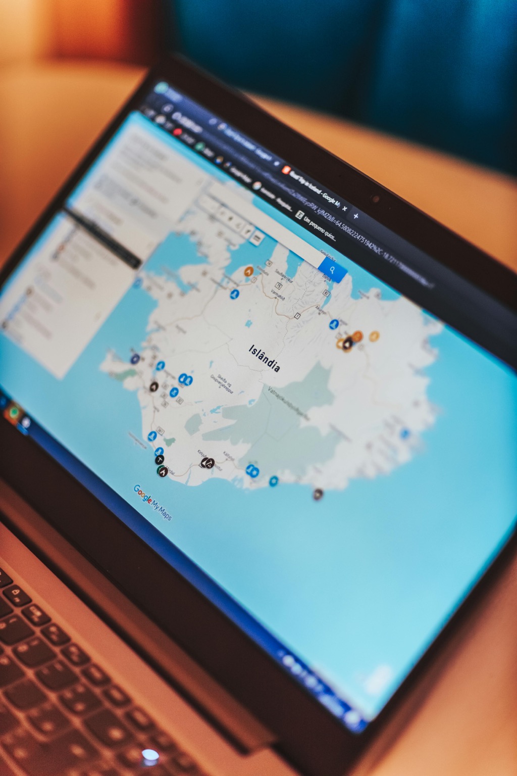
Google My Maps
Google My Maps allows you to create and customize your maps easily. You can add markers, shapes, and layers without needing advanced skills. Its intuitive interface makes navigating a breeze.
Mapbox
Mapbox offers a user-friendly platform for creating customized maps. With its drag-and-drop feature, you can style maps to your liking. Plus, its extensive documentation helps guide you through the process.
Canva
Canva is well-known for graphic design but also supports map creation. You can use its templates to design visually appealing maps quickly, blending aesthetics with functionality.
ArcGIS Online
While ArcGIS may seem complex, ArcGIS Online simplifies mapping tasks. It provides various templates and tools that enable you to create interactive maps efficiently.
OpenStreetMap
OpenStreetMap focuses on collaborative mapping. You can contribute by editing maps or using their data to create your own, fostering a community-driven experience.
By incorporating these tools into your mapping practice, you can develop skills and confidence while producing high-quality maps. Remember to explore available tutorials and resources to enhance your learning experience.
What to Look for in User-Friendly Mapping Software
You often face the challenge of developing maps that are not only informative but also visually appealing to a diverse audience. Whether you’re involved in urban planning, tourism, or environmental studies, the ability to convey information clearly through mapping is essential.
Technical Context
Understanding the technical aspects of cartography is vital in today’s digital landscape. Utilizing Geographic Information Systems (GIS) and data visualization principles can greatly enhance your map-making process. Keep in mind that you’ll need to balance technical rigor with accessibility to ensure your work resonates with users.
Key Methods with Examples
- GIS Software: Programs like ArcGIS Pro offer a robust platform for both beginners and experienced users. They provide powerful analysis tools and are industry-standard for many mapping projects.
- Online Mapping Tools: Tools such as Google My Maps allow you to create customized maps easily without complex software installations. This can help you present geographic data in a more digestible format.
- Data Sources: Make sure to use reliable data sources like USGS or OpenStreetMap. These platforms offer extensive datasets suitable for various mapping needs, ensuring your maps are built on solid foundations.
Address Common Technical Issues
You may encounter common technical issues such as data compatibility and software crashes. To mitigate these problems:
- Check Data Formats: Ensure your data is in a compatible format with your mapping software. Convert files using tools like QGIS if necessary.
- Regular Software Updates: Keep your software updated to minimize bugs and crashes.
- Backup Your Work: Regularly save and backup your projects to cloud storage or external drives to prevent loss.
Data Visualization Options
Effective data visualization is a critical component of cartography. Consider these options:
- Color Schemes: Use color gradients to represent data density effectively. Tools like Tableau can help you create visually striking maps that highlight important information.
- Interactive Elements: Incorporate interactive features using Leaflet or Mapbox to create engaging maps that allow users to explore data dynamically.
Workflow Frameworks
Establishing a systematic approach to your mapping projects can improve efficiency. Here’s a simple framework you can follow:
- Define Objectives: Start by clearly defining the purpose of your map.
- Gather Data: Collect all necessary data from credible sources.
- Create a Rough Draft: Use tools like Scribble Maps to sketch your initial ideas.
- Refine and Analyze: Fine-tune your design and analyze the data for insights.
- Final Review and Quality Control: Conduct thorough QA/QC processes, including checking for accuracy in data representation and ensuring the map is visually appealing.
Quality Control Tips
Quality assurance is essential in mapping. Implement these tips to enhance the reliability and quality of your maps:
- Peer Review: Have colleagues review your maps for clarity and accuracy. Fresh eyes can catch errors you might overlook.
- Data Verification: Always verify your data against reliable sources to ensure its accuracy.
- Iterate Based on Feedback: Be open to constructive criticism and make adjustments accordingly to improve usability and clarity.
By grounding your approach in these technical aspects, you can significantly enhance your mapping skills and create compelling, informative maps that serve your audience effectively.
Top 5 Best User-Friendly Mapping Software for Beginners
Mapping software can simplify your cartography tasks while making the learning process enjoyable. Here are five top-notch options tailored for beginners that combine ease of use with robust features.
1. Google My Maps
Google My Maps is a fantastic starting point for new mapmakers. It’s free to use and built on the familiar Google Maps platform, making navigation intuitive. You can add markers, draw shapes, and import data from spreadsheets effortlessly. Its cloud-based nature means you can access your maps from any device with an internet connection, which is perfect for personal projects and collaboration. Training materials and tutorials are widely available, so you can quickly boost your mapping skills while experimenting with different features.
2. MapQuest
MapQuest offers a user-friendly platform tailored for those new to mapping. With its straightforward interface and essential features, it’s a solid option for beginners looking to create accurate maps without a steep learning curve.
Key Features
- Turn-by-Turn Navigation: Provides precise directions, making it great for real-time navigation.
- Customizable Maps: Allows you to add markers and different routes based on your needs.
- Search Functionality: Includes local business listings, ensuring you can find points of interest easily.
- Integration Options: Integrates with other applications for seamless usability, enhancing your mapping projects.
- Free Access: MapQuest is completely free to use, making it accessible for personal and educational projects.
- Subscription Plans: While the basic features are free, they offer premium services that include advanced functionalities at competitive rates.
- No Hidden Fees: Clear pricing structure ensures that you know what features are available without surprises.
By leveraging MapQuest’s capabilities, you can tackle various mapping projects while enhancing your skills in creating engaging, informative maps.
3. Canva Maps
Canva Maps is a fantastic choice for beginners who want an intuitive platform for map creation. It combines graphic design elements with mapping, making it perfect for visual learners and those unfamiliar with advanced mapping software.
Key Features
- User-Friendly Interface: Canva Maps offers an easy-to-navigate interface, enhancing your experience as you work on map projects.
- Templates and Customization: You’ll find professionally designed templates that you can customize with different colors, fonts, and more, tailoring your maps to your needs.
- Data Visualization: This platform simplifies data visualization, allowing you to create impactful maps without a steep learning curve.
- Sharing and Collaboration: Canva Maps enables you to publish or share your maps easily, embedding them in presentations or reports as needed.
- Drag-and-Drop Tool: You can utilize a convenient drag-and-drop feature to streamline your map creation process.
- Free Plan: Canva offers a free plan packed with basic features, making it accessible for beginners and small projects.
- Pro Version: If you seek advanced features, the Pro version provides additional tools and resources at a reasonable monthly fee.
- Team Collaboration: You can also explore pricing for team collaborations, which includes features catering to multiple users working on shared projects.
- No Hidden Fees: Canva’s pricing is straightforward, ensuring you understand what you’re paying for without unexpected costs.
4. ArcGIS Online
Creating effective maps can often be a daunting challenge, especially when you aim to convey complex information visually. Understanding the principles of cartography is crucial, as it bridges the gap between artistic representation and accurate information delivery. Maps should tell a story and efficiently communicate your message.
You should ground your mapping efforts in established technical knowledge. Familiarity with Geographic Information Systems (GIS) will enhance your ability to manage data, create visual hierarchies, and interpret spatial relationships. These skills are essential as you move from traditional methods to modern digital tools.
Key Methods with Examples
To tackle mapping challenges, consider these key methods:
- Utilize GIS Software: Tools like ArcGIS Pro and QGIS allow you to analyze and visualize geospatial data effectively. They support various formats, enabling a versatile approach.
- Apply Smart Mapping Techniques: Platforms like ArcGIS Online incorporate Smart Mapping features, suggesting optimal symbolization based on your data. This can help streamline the map creation process.
- Incorporate Real-Time Data: Utilizing APIs to pull in relevant, live data can enhance maps’ usability and engagement. For instance, using weather data in emergency management maps provides contemporary relevance.
5. Bing Maps
Bing Maps provides a robust platform packed with features that cater to beginners. It offers intuitive navigation and a range of mapping tools to create effective visualizations.
Key Features
- API Calls: Bing Maps stands out with its free tier, permitting up to 125,000 billable API calls annually for public websites, Android and iOS apps, or Windows apps used internally. If you’re part of an education or non-profit organization, you can leverage 50,000 free calls each day.
- Session IDs: You can utilize session IDs with the Bing Maps HTML5 web control to make up to 25 calls in a single session without incurring costs.
- Integration with Azure: Bing Maps integrates seamlessly with Azure, offering up to 10,000 free API calls per month for public or internal sites. Additional calls are charged at a rate ranging from $0.005 to $0.015 each, depending on your transaction volume.
- Free Access: Bing Maps allows beginners to explore its features at no cost, making it an excellent choice for initial mapping projects.
- Tiered Pricing: Beyond the free tiers, if your needs surpass the allotted calls, costs are tiered based on usage. For general purposes, additional calls are billed at half a cent up to one and a half cents, creating affordable options for scaling your projects.
- Cost-Effectiveness: Budget-minded users can benefit from Bing Maps’ pricing structure, optimizing mapping efforts without prohibitive expenses.
Advantages of Using User-Friendly Mapping Software
User-friendly mapping software simplifies the process of creating maps, making it accessible for beginners. These tools enhance your ability to visualize data effectively, collaborate with others, and engage your audience.
Enhanced Visualization
User-friendly mapping software offers intuitive design elements that aid in creating visually appealing maps. For instance, Google My Maps allows you to easily add markers and draw shapes over a familiar interface. In addition, Datawrapper provides drag-and-drop functionality to create interactive charts and maps, which are ideal for reports. By utilizing Maptive, you can generate dynamic maps featuring heat maps and demographic data, enhancing your ability to convey complex information through effective visuals.
Collaborative Features
User-friendly mapping tools often incorporate collaborative features that enhance teamwork. Tools like Google My Maps allow multiple users to edit and share maps seamlessly, promoting real-time collaboration. Similarly, Canva Maps enables you to design engaging visuals while inviting team members to contribute to projects easily. This accessibility means you can gather diverse input effortlessly and produce high-quality maps that reflect the shared knowledge and creativity of your group.
Conclusion
Embracing user-friendly mapping software opens up a world of possibilities for beginners. You don’t need to be an expert to create stunning maps that effectively communicate your ideas. With tools like Google My Maps and Canva Maps at your disposal, you can easily navigate the mapping landscape.
These platforms not only simplify the creation process but also enhance your skills as you explore their features. As you gain confidence in your mapping abilities, remember to utilize available tutorials and resources. By doing so, you’ll continuously improve and produce maps that truly resonate with your audience. Dive in and start mapping your journey today.


