12 Best Surveying Tools for Accurate Field Data That Improve Precision
Accurate field data is essential for successful surveying, impacting everything from construction projects to land assessments. With the right tools, you can streamline your workflow and enhance precision in your measurements. Discover the best surveying tools that will elevate your fieldwork and ensure reliable results.
Total Stations
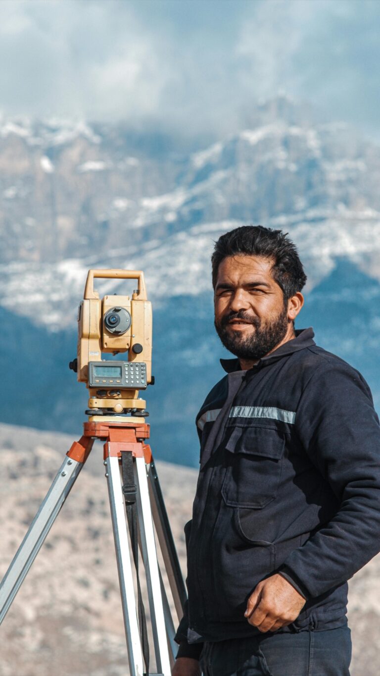
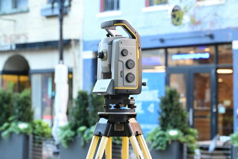
Total stations combine a theodolite with an electronic distance measuring device. They allow you to measure angles and distances simultaneously, optimizing time on-site. Popular models include the Leica TS16 and Trimble S5, both known for their precision and durability.
GPS Receivers
Utilizing GPS receivers ensures you capture location data accurately. Differential GPS (DGPS) significantly improves location accuracy, essential for tasks like land surveying. The Trimble R10 is a top choice, offering real-time corrections and impressive accuracy.
Digital Levels
Digital levels streamline the elevation measurement process. Compared to traditional levels, they minimize human error and enhance reliability. The Leica DNA03 is a leading option, delivering exceptional precision in leveling tasks.
3D Laser Scanners
For complex surveying projects, 3D laser scanners provide detailed data capture of the environment. These tools enable you to create comprehensive point clouds for analysis. The FARO Focus series is favored for its speed and accuracy in capturing three-dimensional data.
Drones
Incorporating drones into your surveying toolkit allows for rapid aerial data collection, particularly for large or inaccessible areas. They can capture high-resolution imagery and generate orthomosaics. Model options like the DJI Phantom 4 RTK are popular for their mapping capabilities.
Data Management Software
Master AutoCAD Civil 3D 2025 with this comprehensive guide. Learn essential techniques for efficient civil engineering design and documentation.
Efficient data management is integral to accurate surveying. Software like AutoCAD Civil 3D and ArcGIS offers robust platforms for organizing, analyzing, and visualizing field data. Ensure your chosen software is compatible with your field tools to maximize efficiency.
Quality Control Tips
Maintain high standards by implementing QA/QC procedures. Regularly calibrate equipment, verify data against known benchmarks, and document findings meticulously. This process ensures your surveying results are both reliable and actionable.
By integrating these tools into your workflow, you can enhance the accuracy of your field data collection and deliver higher quality mapping outcomes.
Understanding The Importance Of Accurate Field Data
Accurate field data is essential for effective surveying in construction and engineering. It informs your project decisions and ensures that you’re working with dependable information.
The Role Of Surveying In Construction
Surveying serves as the backbone of any construction project. You rely on accurate surveys to measure site geometry, identify property boundaries, and assess existing structures. Effective surveys guide your design process, helping you minimize errors before they impact the work. Tools like total stations and GPS receivers are essential for collecting this data, ensuring that your measurements are precise and reliable.
The Impact Of Accurate Data On Projects
Accurate data significantly impacts project efficiency and decision-making. You can avoid costly rework and delays by having solid, accurate information. When your team communicates seamlessly based on reliable data, you enhance collaboration and reduce labor hours. Leveraging tools such as digital levels and 3D laser scanners can help you gather this data effectively, keeping your projects on track and within budget.
Essential Features To Look For In Surveying Tools
As a cartographer, you often face the challenge of collecting accurate field data amidst varying environmental conditions. Whether you’re mapping urban landscapes or remote terrains, the tools you choose can significantly impact your workflow efficiency and data quality.
Technical Context: Importance of Reliable Surveying Tools
In your mapping efforts, the choice of surveying tools is crucial. These tools are designed to withstand harsh conditions, ensuring that you capture precise data critical for your projects. The appropriate technology not only enhances data accuracy but also improves your overall productivity in the field.
Key Methods and Tool Examples
- Total Stations: Total stations combine electronic theodolites with distance measurement technology. Tools like the Leica TS16 offer superior precision for land surveys, crucial for construction projects. Total stations enable you to measure angles and distances with high accuracy, simplifying complex survey tasks.
- GPS Receivers: Using high-precision GPS receivers such as the Trimble R10 allows you to achieve centimeter-level accuracy in your positioning. These devices are essential when working in challenging environments where traditional surveying methods may fall short.
- 3D Laser Scanners: Tools like the FARO Focus provide detailed 3D scans of environments quickly. This technology captures vast amounts of data swiftly, offering a comprehensive view of the landscape for various applications from urban planning to heritage preservation.
- Drones: Incorporating drones, like the DJI Matrice 300 RTK, into your workflow allows for aerial data collection. Drones provide a unique vantage point, reducing time spent on surveys while enhancing coverage and detail.
Common Technical Issues and Resolutions
While using advanced tools, you may encounter issues like data loss or miscalculations due to environmental interferences. To mitigate these risks, ensure you:
- Calibrate equipment regularly before fieldwork to guarantee accuracy.
- Use redundant systems, such as additional data sources or backup devices, to safeguard against data loss.
- Conduct regular training on tool operation and troubleshooting to equip yourself with necessary skills.
Data Visualization Options: Presenting Your Findings
Effective data visualization is paramount in communicating your findings to stakeholders. Use software like ArcGIS Pro or QGIS to create compelling maps that illustrate your data clearly. Key visualization options include:
- Choropleth maps for displaying quantitative data variations.
- Heat maps to visualize density or intensity distributions.
- 3D visualizations to reflect complex terrain accurately.
Workflow Frameworks for Efficient Mapping
To streamline your mapping processes, consider implementing the following workflow steps:
- Planning: Define your objectives and identify necessary tools.
- Data Collection: Utilize the right surveying equipment for field data.
- Data Processing: Analyze and clean your data using GIS software.
- Visualization: Present your results through clear, informative maps.
Quality Control Tips: Maintaining High Standards
Quality assurance and control (QA/QC) are vital for ensuring the accuracy and reliability of your mapping projects. Here are a few practices to include in your workflow:
- Conduct field checks to validate collected data against known benchmarks.
- Peer reviews of your findings can catch potential errors before finalizing reports.
- Maintain a comprehensive log of data sources and methodologies for transparency and reproducibility.
By grounding your mapping efforts in these methods and leveraging the right tools, you can enhance your data accuracy and deliver quality outputs with confidence.
Top Surveying Tools For Accurate Field Data
Mapping can be complex, especially when trying to capture accurate geographical features while meeting tight deadlines. You might face challenges like transitioning from raw field data to refined digital maps or ensuring data compatibility across various platforms.
Establishing Technical Context
In today’s fast-paced mapping environment, leveraging the right digital tools is essential. Understanding the technologies available can significantly improve your results. Accurate tools enhance not just precision but also your workflow efficiency, allowing you to deliver high-quality maps with confidence.
Key Methods to Improve Your Craft
Utilize the Right Software
- Use advanced GIS tools like ArcGIS and QGIS for data analysis and visualization. These tools offer robust features for spatial analysis and mapping.
- Implement visualization software like Tableau to create engaging maps that effectively present your findings to stakeholders.
Incorporate Field Data Tools
- Embrace portable GPS devices and total stations to capture accurate geographical data.
- Consider 3D laser scanners for detailed topographical surveys, providing you with precise measurements for complex terrains.
Common Technical Issues and Resolutions
You might encounter several challenges during the mapping process:
- Inaccurate Data Capture: This often arises from improper calibration of equipment. Ensure that all GPS receivers and total stations are regularly calibrated.
- Data Compatibility: You could face issues when different software or tools output data in incompatible formats. Always verify compatibility before beginning your mapping projects, and convert data as necessary.
Exploring Data Visualization Options
Effective data visualization is essential for communicating complex map information clearly. Use tools that enhance readability:
- ArcGIS StoryMaps can combine maps with narrative text, images, and multimedia for compelling presentations.
- Employ heat maps or choropleth maps to convey data density or distribution patterns effectively. This approach can simplify complex datasets for your audience.
Workflow Frameworks for Effective Mapping
Planning
Clearly define your project scope and objectives before heading into the field to maximize efficiency.
Data Collection
Use standardized tools and protocols to ensure reliability in the field data you collect.
Processing
Utilize GIS software to analyze and manipulate your data, ensuring it aligns with your mapping goals.
Visualization and Presentation
Tailor your deliverables to the needs of your stakeholders, balancing detail with clarity.
Quality Control Tips
Maintaining high mapping standards is crucial:
- Conduct Regular Quality Checks: Establish a routine for peer reviews and field validations to ensure your maps’ accuracy and reliability.
- Document Your Processes: Keep a detailed record of methods and data sources you use for future reference or audits. This practice can help address issues swiftly and accurately when they arise.
By integrating these strategies, you can enhance your mapping practices, delivering exceptional results that stand up to professional scrutiny.
Comparing The Best Surveying Tools For Accurate Field Data
Selecting the right surveying tools is crucial for obtaining precise field data. By comparing options based on price, performance, and customer feedback, you’ll make informed decisions that enhance your surveying outcomes.
Price Range And Value
When considering surveying tools, it’s essential to align price with value. Total stations, like the Leica FlexLine TS03, can range from several thousand dollars, while robotic options like the Leica iCON iCR80 may have higher initial costs but offer features that justify the investment. GPS systems, such as the Leica GS18 T GNSS RTK Rover, generally fall in the $3,000 to $3,200 range. You’ll want to weigh these costs against your project’s specific needs and expected efficiency gains.
Performance And Efficiency
Performance and efficiency are key aspects to consider in surveying tools. A total station maximizes accuracy by integrating angle and distance measurements, while robotic systems enable one-person operation, significantly streamlining workflows. GPS/GNSS systems ensure high precision in positioning, which can drastically cut down on time spent in the field. Combining these tools with GIS software can further enhance data management and access to real-time information.
Master ArcGIS Pro 3.2 with this comprehensive guide. Learn essential GIS workflows and data management techniques for effective spatial analysis.
Customer Reviews And Recommendations
Customer reviews can provide invaluable insights into the reliability and usability of surveying tools. Products like the Leica FlexLine TS03 consistently receive positive feedback for their durability and accuracy. Users often recommend the Leica iCON iCR80 for its intuitive controls and adaptability to various surveying situations. Analyzing ratings and testimonials from industry professionals can guide you in selecting equipment that meets your needs while ensuring a return on investment.
Conclusion
Accurate field data is essential for successful surveying and project execution. By selecting the right tools you can significantly enhance your workflow and ensure precise measurements. Whether you choose total stations GPS receivers or advanced 3D laser scanners each tool offers unique benefits that cater to various surveying needs.
Emphasizing quality control and effective data management will further bolster your surveying practices. By staying informed about the latest technologies and techniques you’ll be better equipped to tackle challenges and deliver reliable results. Investing in the best surveying tools not only streamlines your work but also contributes to the overall success of your projects.
